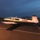
A64Pilot Posted August 14, 2021 Report Posted August 14, 2021 7 hours ago, toto said: Looks like you can change your address “releasability status” online here.. https://amsrvs.registry.faa.gov/amsrvs/Logon.asp Outstanding, thanks I needed to order new Certs anyway Quote
A64Pilot Posted August 14, 2021 Report Posted August 14, 2021 You can limit your ADSB data released here https://ladd.faa.gov/Home/Welcome#FileRequest probably not as good a privacy option as this, but I think this is a biz jet thing, and most of us aren’t 1098 I don’t think. https://www.faa.gov/nextgen/equipadsb/privacy/ Quote
hoot777 Posted August 14, 2021 Report Posted August 14, 2021 Davidv’s points are well taken. This one hurts to watch. I have seen it implied he was a fairly new pilot - then I see a statement he’s been a pilot for 40 years. Anyone have the info ? I’m an old military/ airline guy who use to be a structural engineer and my gut says loss of control or severe turbulence from convective activity. Also his tower transmission s lead one to question his physical and mental state. Thoughts and prayers to the families involved. Hopefully we can solve the mystery. 2 Quote
tigers2007 Posted August 14, 2021 Report Posted August 14, 2021 I hope I'm not threadcrapping here but its my understanding that there is zero evidence that this gentleman was a newer pilot. There seems to be ample internet anecdotes referencing him; for example: Alexandria Echo Press Golberg said James Edney, 72, was well known among the Alexandria pilot community. “Really a great group of people, very close,” Goldberg said of the Edneys. There had recently been a large family gathering, including Jim Edney’s siblings, at Lake Miltona, where Edney had spent time since he was a child. Golberg said Jim Edney was an experienced pilot and that they had flown together for about 20 years and called the death’ “devastating.” 1 Quote
A64Pilot Posted August 14, 2021 Report Posted August 14, 2021 It’s a normal human reaction for people to try to find something different with the accident pilot than them, then they can rest easier as they can feel better about it not happening to them. It’s not being mean or whatever it’s just people want to find out that something bad like this won’t happen to them. So they start theorizing new pilot. not very proficient, aircraft not equipped with as good equipment as they have etc. All accidents are a chain of events and the reason I’m alive today is I’m sure that the chain has so far remained unbroken for me, it’s not my superior skills or judgement, not really. Sometimes bad things happen to good pilots. I think of Scott Crossfield, very few can consider themselves as good a pilot as he was. I’m not saying that our actions don’t change events, of course they do, just saying that except for the grace of God, that could have been me. 3 Quote
Marauder Posted August 14, 2021 Report Posted August 14, 2021 Yeah,I’ve had a heartache about that forever, your tail number gives out your home address etc. Personal data from an A&P license number, which has to be on any logbook entry an A&P makes is just as easy to find. So why is that?It’s slowly starting to change with GDPR. The EU has adopted these new privacy requirements as has California and Brazil. It’s headed that way for exactly the reasons you mentioned.Sent from my iPad using Tapatalk Pro Quote
toto Posted August 14, 2021 Report Posted August 14, 2021 On 8/13/2021 at 1:10 PM, ilovecornfields said: I think most modern autopilots fly approaches better than most modern pilots… I got my IR in a plane without an autopilot, and flew IFR for many years after that with no AP. The AP definitely makes things easier, and is way less fatiguing than hand-flying in IMC. But hand-flying in IMC requires a great deal of focus and attention at all times, and one of the hardest things about AP flying is maintaining a similar level of attention while George has the controls. I lost a couple of vacuum pumps during my non-AP days, and it's pretty easy to pick up a sluggish AI when you're doing a focused, continuous scan. But it's soooo easy to lose a minute here or there when the AP is flying, and you really need a strict sterile cockpit during critical phases of flight if you want to maintain "manual" levels of attention while benefiting from the precision of automation. 1 Quote
Hank Posted August 14, 2021 Report Posted August 14, 2021 5 hours ago, A64Pilot said: It’s a normal human reaction for people to try to find something different with the accident pilot than them, then they can rest easier as they can feel better about it not happening to them. It’s not being mean or whatever it’s just people want to find out that something bad like this won’t happen to them. So they start theorizing new pilot. not very proficient, aircraft not equipped with as good equipment as they have etc. Back where the screenshots of airplane registration are, there's another one of the pilot's FAA information, which says license was issued in 2016. Looking myself up, or checking the plastic card in my wallet, shows the Issue Date when I passed my most recent checkride, not the first one. If a pilot doesn't fly for a period of time, then gets a new card, what date would it show? Maybe this pilot added a new Rating or Class to his PPL back in 2016, but he could have easily received his PPL 56 years ago, we don't know and can't tell from simple internet searches. 2 Quote
Shadrach Posted August 14, 2021 Report Posted August 14, 2021 1 minute ago, Hank said: Back where the screenshots of airplane registration are, there's another one of the pilot's FAA information, which says license was issued in 2016. Looking myself up, or checking the plastic card in my wallet, shows the Issue Date when I passed my most recent checkride, not the first one. If a pilot doesn't fly for a period of time, then gets a new card, what date would it show? Maybe this pilot added a new Rating or Class to his PPL back in 2016, but he could have easily received his PPL 56 years ago, we don't know and can't tell from simple internet searches. Exactly. My FAA information shows a certificate date of 2010 but I got my ticket in 1998. Quote
tigers2007 Posted August 14, 2021 Report Posted August 14, 2021 The date is what it is. It is the date of certificate issuance. Period. If today "Sully" loses his certificate or changes his address and subsequently applies for a replacement then BOOM! He gets a certificate issued in 2021. Quote
neilpilot Posted August 14, 2021 Report Posted August 14, 2021 34 minutes ago, Shadrach said: Exactly. My FAA information shows a certificate date of 2010 but I got my ticket in 1998. My FAA information shows a certificate date of 2016 but I got my ticket in 1972 1 Quote
Hank Posted August 14, 2021 Report Posted August 14, 2021 1 hour ago, neilpilot said: My FAA information shows a certificate date of 2016 but I got my ticket in 1972 Hi there, you new pilot! 1 1 Quote
A64Pilot Posted August 15, 2021 Report Posted August 15, 2021 3 hours ago, neilpilot said: My FAA information shows a certificate date of 2016 but I got my ticket in 1972 You probably got new ones then. Mine reset the date when I changed my number from my SS number, andI just sent off for new Certs today, I expect when I get them they will be dated 2021. So how does a FSDO inspector know how long you have been a pilot or mechanic? Quote
Hank Posted August 15, 2021 Report Posted August 15, 2021 19 minutes ago, A64Pilot said: So how does a FSDO inspector know how long you have been a pilot or mechanic? Not by googling your name . . . . Quote
eman1200 Posted August 15, 2021 Report Posted August 15, 2021 I hope I'm not threadcrapping here but its my understanding that there is zero evidence that this gentleman was a newer pilot. There seems to be ample internet anecdotes referencing him; for example: Alexandria Echo Press Golberg said James Edney, 72, was well known among the Alexandria pilot community. “Really a great group of people, very close,” Goldberg said of the Edneys. There had recently been a large family gathering, including Jim Edney’s siblings, at Lake Miltona, where Edney had spent time since he was a child. Golberg said Jim Edney was an experienced pilot and that they had flown together for about 20 years and called the death’ “devastating.”Part of it stems from the “brilliant” video by the blancolirio guy (very experienced aviator) who (mis)stated in his brilliant video that the guy was recently PPL’d. Quote
Raymond J1 Posted August 15, 2021 Report Posted August 15, 2021 6 hours ago, neilpilot said: My FAA information shows a certificate date of 2016 but I got my ticket in 1972 If the FAA says so... So you were in training from 1972 to 2016... Now you are a newly licensed young driver... LOL Quote
chriscalandro Posted August 15, 2021 Report Posted August 15, 2021 My first card didn’t have an issued date. A second one with an issued date showed up the next day Quote
jlunseth Posted August 15, 2021 Report Posted August 15, 2021 We need to be careful about using public ADSB data to calculate anything other than very gross climb and descent rates, or to say whether the subject aircraft was in the clouds or just above. Remember some things about ADSB reporting. As I understand it, ADSB altitude comes from a blind encoder. The blind encoder uses 29.92 as its pressure reference, not the actual local pressure. ATC’s systems convert that to a pressure altitude. Our ADSB out units report in increments of 100 feet. Yesterday, because I was a little concerned about the accuracy of all this, I watched what my KT74 was reporting west of FCM. At one point it was flipping altitudes for several minutes from 2500 to 2600 and back on intervals of ten seconds or less, with no actual altitude changes going on except ground turbulence variances of maybe 20 feet or so. My actual pressure altitude at that point was 2800, not 2500. The ambient pressure was 30.22, so a difference of about .30 inches hmg from 29.92 and therefore the 300 feet. So the ADSB Exchange information that people have been using, is that recording altitude after it is translated to pressure altitude by the ATC system, or is it just reporting what comes out of the transponder, which is generally several hundred feet different from pressure altitude? I looked at their website and it says the data is not FAA data, it comes from a web of all kinds of harvesters, including amateur harvesters. They are very proud of that. For our purposes, that virtually guarantees that it is data not translated to pressure altitude, so it does not represent the actual altitude that the aircraft was flying at. There is no doubt that there was a high descent rate in the last seconds of flight. There is no doubt that the pilot went through the cloud deck. But reading the ADSB data to suggest the pilot was dipping in and out of the clouds or constantly climbing and descending prior to the final turn, just misunderstands the nature of the data. The data is not accurate enough to tell us those things. 7 Quote
Shadrach Posted August 15, 2021 Report Posted August 15, 2021 9 minutes ago, jlunseth said: We need to be careful about using public ADSB data to calculate anything other than very gross climb and descent rates, or to say whether the subject aircraft was in the clouds or just above. Remember some things about ADSB reporting. As I understand it, ADSB altitude comes from a blind encoder. The blind encoder uses 29.92 as its pressure reference, not the actual local pressure. ATC’s systems convert that to a pressure altitude. Our ADSB out units report in increments of 100 feet. Yesterday, because I was a little concerned about the accuracy of all this, I watched what my KT74 was reporting west of FCM. At one point it was flipping altitudes for several minutes from 2500 to 2600 and back on intervals of ten seconds or less, with no actual altitude changes going on except ground turbulence variances of maybe 20 feet or so. My actual pressure altitude at that point was 2800, not 2500. The ambient pressure was 30.22, so a difference of about .30 inches hmg from 29.92 and therefore the 300 feet. So the ADSB Exchange information that people have been using, is that recording altitude after it is translated to pressure altitude by the ATC system, or is it just reporting what comes out of the transponder, which is generally several hundred feet different from pressure altitude? I looked at their website and it says the data is not FAA data, it comes from a web of all kinds of harvesters, including amateur harvesters. They are very proud of that. For our purposes, that virtually guarantees that it is data not translated to pressure altitude, so it does not represent the actual altitude that the aircraft was flying at. There is no doubt that there was a high descent rate in the last seconds of flight. There is no doubt that the pilot went through the cloud deck. But reading the ADSB data to suggest the pilot was dipping in and out of the clouds or constantly climbing and descending prior to the final turn, just misunderstands the nature of the data. The data is not accurate enough to tell us those things. You make an excellent point. I’m surprised this didn’t come up earlier. 1 Quote
toto Posted August 15, 2021 Report Posted August 15, 2021 2 hours ago, Shadrach said: You make an excellent point. I’m surprised this didn’t come up earlier. Also worth noting that even the on-site NTSB spokesperson said that they were relying on ADS-B data for initial assessments. So we should probably take his comments with a grain of salt too. I assume that their official reporting will be based on more reliable (but less convenient) sources. Quote
Shadrach Posted August 15, 2021 Report Posted August 15, 2021 On 8/15/2021 at 2:11 PM, toto said: Also worth noting that even the on-site NTSB spokesperson said that they were relying on ADS-B data for initial assessments. So we should probably take his comments with a grain of salt too. I assume that their official reporting will be based on more reliable (but less convenient) sources. Not necessarily a grain of salt but the data needs to be better analyzed. We have no idea how close the ADS-b returns are to actual altitude. But interesting is to look at some of my own information on ADSB exchange. It’s clear that the software recognizes what is there for use on the ground. It appears to revert to what looks like MSL as soon as the aircraft is airborne. My plane climbed well that day but it 7250fpm was not in the cards…. Quote
jlunseth Posted August 16, 2021 Report Posted August 16, 2021 Aside from issues with the data, the rounding effect or whatever you want to call it, will distort climb and descent rates over altitude changes of a few hundred feet, which is what we are talking about with this incident. Here is a simple example. The transponder reports in increments of 100 feet so it necessarily rounds up or down at some point. Let’s say it does that at 50 feet. So if you are flying at 3040 the transponder reports 3000 (setting aside the pressure altitude issue for the moment). At 3060 feet it reports 3100, so it says you have ascended 100 feet between the two ADSB broadcast although the actual altitude change was just 20 feet. The maximum distortion is about 200 feet of altitude. Say you start at 3040 and ascend to 3160. You would ascend 120 feet but ADSB would report 300. My simple example is just to explain the rounding effect, but it is more prevalent in real life flying and not as clean as in my example. I flew with an MX20 for many years that reported encoder altitude, altered for local pressure. It was always off and in weird amounts. If you are climbing or descending, say, 10,000 feet the potential distortion is still only 200 feet so percentage-wise it is small. But if you are going from 3000 to 3100 the distortion can be substantial. I did a tour of an ATC facility years ago. They told us they are aware of these issues and do not pay attention to reported altitude changes of less than 200 feet. As I said in my earlier post there is no doubt there was a significant altitude and speed change in this instance. I am just saying we can’t use that data at the granular level we would like because it is just not that accurate. Also, I would like to see the actual data and know how it was put together. I read the ADSB Exchange web page, it looks like the data is harvested by hobbyists with a Raspberry Pi, a Software Defined Radio and an antenna. I looked at sample data and it is not in the format that it is presented in the graphics in this thread, so at some point the actual data is translated. How, what choices are made? Are parts of the data from multiple harvesters put together into one data stream? Is it AGL, MSL, pressure compensated (it appears not to be)? I am not saying it is not useful, I would certainly not stake my life and fly my aircraft based on the data, not at this point. Notwithstanding, it is still interesting and it is data. 2 Quote
Shadrach Posted August 16, 2021 Report Posted August 16, 2021 (edited) 1 hour ago, jlunseth said: Aside from issues with the data, the rounding effect or whatever you want to call it, will distort climb and descent rates over altitude changes of a few hundred feet, which is what we are talking about with this incident. Here is a simple example. The transponder reports in increments of 100 feet so it necessarily rounds up or down at some point. Let’s say it does that at 50 feet. So if you are flying at 3040 the transponder reports 3000 (setting aside the pressure altitude issue for the moment). At 3060 feet it reports 3100, so it says you have ascended 100 feet between the two ADSB broadcast although the actual altitude change was just 20 feet. The maximum distortion is about 200 feet of altitude. Say you start at 3040 and ascend to 3160. You would ascend 120 feet but ADSB would report 300. My simple example is just to explain the rounding effect, but it is more prevalent in real life flying and not as clean as in my example. I flew with an MX20 for many years that reported encoder altitude, altered for local pressure. It was always off and in weird amounts. If you are climbing or descending, say, 10,000 feet the potential distortion is still only 200 feet so percentage-wise it is small. But if you are going from 3000 to 3100 the distortion can be substantial. I did a tour of an ATC facility years ago. They told us they are aware of these issues and do not pay attention to reported altitude changes of less than 200 feet. As I said in my earlier post there is no doubt there was a significant altitude and speed change in this instance. I am just saying we can’t use that data at the granular level we would like because it is just not that accurate. Also, I would like to see the actual data and know how it was put together. I read the ADSB Exchange web page, it looks like the data is harvested by hobbyists with a Raspberry Pi, a Software Defined Radio and an antenna. I looked at sample data and it is not in the format that it is presented in the graphics in this thread, so at some point the actual data is translated. How, what choices are made? Are parts of the data from multiple harvesters put together into one data stream? Is it AGL, MSL, pressure compensated (it appears not to be)? I am not saying it is not useful, I would certainly not stake my life and fly my aircraft based on the data, not at this point. Notwithstanding, it is still interesting and it is data. Agreed. Taking the time and altitude data on adsbexchange generates descent rates that seem next to impossible because they likely are. Nevertheless, even adjusting for those errors, I have never seen an ADS-b track that comes close to this one. I don’t know anyone who is currently flying hard aerobatics but it would be interesting to compare the ADS-b data to the cockpit data. As I said earlier, something as big, dirty and underpowered as a Stearman performing a loop will see rates in excess of 10,000fpm. An Extra 300, will see quite a bit more and is likely more comparable to a Mooney heading downhill under power. Edited August 16, 2021 by Shadrach 3 Quote
hoot777 Posted August 16, 2021 Report Posted August 16, 2021 I’m as interested as any Mooney guy in what happened. Hopefully we can figure it out but I thought I’d bring up a little bit of physics and a lesson from my B24 pilot dad which is to never ever yank!!! On an airplane. Remember from basic physics F=MA- well a yank of about 6.7 gs will rip a Mooney s wings or at least bend them. That’s using the 20000 lb static load number I’ve seen tossed about. The yank lesson was taught with me at the controls of a 210 in the sixties and I Yanked on the elevator. I thought my dad was going to hit me. He did not but he got his point across very sternly. Fly safely,again thoughts and prayers to this family and let’s all be patient with the investigation. Maybe somebody more versed in physics can enlighten us more. 2 Quote
Shadrach Posted August 16, 2021 Report Posted August 16, 2021 5 minutes ago, hoot777 said: I’m as interested as any Mooney guy in what happened. Hopefully we can figure it out but I thought I’d bring up a little bit of physics and a lesson from my B24 pilot dad which is to never ever yank!!! On an airplane. Remember from basic physics F=MA- well a yank of about 6.7 gs will rip a Mooney s wings or at least bend them. That’s using the 20000 lb static load number I’ve seen tossed about. The yank lesson was taught with me at the controls of a 210 in the sixties and I Yanked on the elevator. I thought my dad was going to hit me. He did not but he got his point across very sternly. Fly safely,again thoughts and prayers to this family and let’s all be patient with the investigation. Maybe somebody more versed in physics can enlighten us more. Mooney wings have survived G loads well beyond +6.7Gs without damage both in flight and in testing. The story of the jig breaking at 9+Gs during testing has been supported by witness accounts. They are not indestructible by any means but +6.7Gs is not likely going to do it. In fact, I think that most GA airframes have enough margin designed in to withstand +6.7Gs without damage. 1 Quote
Recommended Posts
Join the conversation
You can post now and register later. If you have an account, sign in now to post with your account.