aviatoreb Posted August 5, 2021 Report Posted August 5, 2021 11 hours ago, Skates97 said: Not necessarily. The metar may report clear skies, but smoke is a different animal. In September 2020 we flew SoCal up to Sun River OR for the West Coast Mooney Retreat. Michael wasn't able to get through the day before because of smoke. We made it there and then on the way back we went out to the coast to be west of the fires and smoke. I was planning a fuel stop in Tracy KTCY and keeping an eye on the metar in flight. It was reporting clear below 12k and 10 mi visibility. I passed up some other airports along the way because my planned stop looked good. As we descended through a smoke layer it was nothing near clear skies and 10 mi visibility. If it was 3 mi that is extremely generous, it was probably more like 1 1/2 and the layer began at about 1,800' and went up to about 5,000'. I don't know what it is about smoke but it doesn't register right on an AWOS for ceiling and visibility. I flew the approach just in case since at 5k I honestly didn’t know what it would look like. It ended up murky but plausible to fly vfr from but still not so easy to find the airport without good instrumentation. Better to just show up at the airport all lined up snd at good altitudes - approach plates can be nice in legal vfr sometimes. 2 Quote
Ragsf15e Posted August 5, 2021 Author Report Posted August 5, 2021 55 minutes ago, Skates97 said: Not necessarily. The metar may report clear skies, but smoke is a different animal. In September 2020 we flew SoCal up to Sun River OR for the West Coast Mooney Retreat. Michael wasn't able to get through the day before because of smoke. We made it there and then on the way back we went out to the coast to be west of the fires and smoke. I was planning a fuel stop in Tracy KTCY and keeping an eye on the metar in flight. It was reporting clear below 12k and 10 mi visibility. I passed up some other airports along the way because my planned stop looked good. As we descended through a smoke layer it was nothing near clear skies and 10 mi visibility. If it was 3 mi that is extremely generous, it was probably more like 1 1/2 and the layer began at about 1,800' and went up to about 5,000'. I don't know what it is about smoke but it doesn't register right on an AWOS for ceiling and visibility. Interesting. I agree the ceiling doesn’t show smoke, but ive routinely seen the vis accurately reported on metars. It might depend on the type of system. I’ll say this, if you’re flying anywhere near smoke, be careful because you could easily go imc and need an approach to mins. It can happen pretty fast. Also, it’s tought to get on top of it in Washington, Oregon, idaho without oxygen. Smoke tops are about 14,000’ ish right now. 1 Quote
Hank Posted August 5, 2021 Report Posted August 5, 2021 1 hour ago, Skates97 said: Not necessarily. The metar may report clear skies, but smoke is a different animal. In September 2020 we flew SoCal up to Sun River OR for the West Coast Mooney Retreat. Michael wasn't able to get through the day before because of smoke. We made it there and then on the way back we went out to the coast to be west of the fires and smoke. I was planning a fuel stop in Tracy KTCY and keeping an eye on the metar in flight. It was reporting clear below 12k and 10 mi visibility. I passed up some other airports along the way because my planned stop looked good. As we descended through a smoke layer it was nothing near clear skies and 10 mi visibility. If it was 3 mi that is extremely generous, it was probably more like 1 1/2 and the layer began at about 1,800' and went up to about 5,000'. I don't know what it is about smoke but it doesn't register right on an AWOS for ceiling and visibility. I've had this happen simply from haze..clear and great visibility at 9-10 k, no clouds. Begin descending, after a couple thousand feet the view goes white and stays there until hilltops appear around 3000. By pattern altitude, visibility was great again. ATIS said clear and >10 miles . . . . . 1 Quote
Hank Posted August 5, 2021 Report Posted August 5, 2021 1 hour ago, Skates97 said: Not necessarily. The metar may report clear skies, but smoke is a different animal. In September 2020 we flew SoCal up to Sun River OR for the West Coast Mooney Retreat. Michael wasn't able to get through the day before because of smoke. We made it there and then on the way back we went out to the coast to be west of the fires and smoke. I was planning a fuel stop in Tracy KTCY and keeping an eye on the metar in flight. It was reporting clear below 12k and 10 mi visibility. I passed up some other airports along the way because my planned stop looked good. As we descended through a smoke layer it was nothing near clear skies and 10 mi visibility. If it was 3 mi that is extremely generous, it was probably more like 1 1/2 and the layer began at about 1,800' and went up to about 5,000'. I don't know what it is about smoke but it doesn't register right on an AWOS for ceiling and visibility. I've had this happen simply from haze..clear and great visibility at 9-10 k, no clouds. Begin descending, after a couple thousand feet the view goes white and stays there until hilltops appear around 3000. By pattern altitude, visibility was great again. ATIS said clear and >10 miles . . . . . 1 Quote
carusoam Posted August 5, 2021 Report Posted August 5, 2021 Sensing water in the air… vs. sensing solid smoke particles in the air… Must take a certain amount of calibration for the sensors… Lets see if our weather guy @Scott Dennstaedt, PhD has any insight on why our weather reporting systems don’t handle smoke very well… Best regards, -a- 1 Quote
LevelWing Posted August 5, 2021 Report Posted August 5, 2021 2 hours ago, Ragsf15e said: Interesting. I agree the ceiling doesn’t show smoke, but ive routinely seen the vis accurately reported on metars. It might depend on the type of system. I’ll say this, if you’re flying anywhere near smoke, be careful because you could easily go imc and need an approach to mins. It can happen pretty fast. Also, it’s tought to get on top of it in Washington, Oregon, idaho without oxygen. Smoke tops are about 14,000’ ish right now. I'm researching portable O2 systems so that I can safely get on top of these smoke layers, assuming they top out at 14,000-15,000 feet or so. That's separate from how long it may take me to get there, but I'm going to try. 1 Quote
KSMooniac Posted August 5, 2021 Report Posted August 5, 2021 I'm looking to refill my portable tank now, ahead of a trip to ID a week from Friday. I hope it doesn't get any worse... Sent from my LM-V405 using Tapatalk Quote
Hank Posted August 5, 2021 Report Posted August 5, 2021 7 hours ago, LevelWing said: I'm researching portable O2 systems so that I can safely get on top of these smoke layers, assuming they top out at 14,000-15,000 feet or so. That's separate from how long it may take me to get there, but I'm going to try. It's not fast in our planes. Watch the DA, that's what counts. I took a CFII and bottle of oxygen out once, just to see what it was like. We topped out rather anemically at 15,000. Flies pretty slow and I don't like the mushy handling. Had to level off twice to build airspeed before resuming the climb. I wrote down the conditions and later calculated that the 15,000 msl where we stopped was 18,800 DA. But the Emergency descent practice coming down was fun! Quote
Scott Dennstaedt, PhD Posted August 5, 2021 Report Posted August 5, 2021 13 hours ago, carusoam said: Lets see if our weather guy @Scott Dennstaedt, PhD has any insight on why our weather reporting systems don’t handle smoke very well… An automated system cannot report smoke (FU). It can be augmented by a human observer, however. Typically with smoke an automated observation will be sensed as lower visibility and typically given a haze (HZ) obstruction to vis. Unless there's a distinct fire nearby, you will usually get a clear below 12,000 indication for ceiling. Here's an example from EZWxBrief. The sky is reported as clear below 12,000 feet and the visibility is in the IFR category with 2.5 miles vis and haze. There's no way to know if the reduced vis was due to smoke without an augmented report from a trained observer. 3 Quote
Ragsf15e Posted August 5, 2021 Author Report Posted August 5, 2021 17 hours ago, aviatoreb said: I flew the approach just in case since at 5k I honestly didn’t know what it would look like. It ended up murky but plausible to fly vfr from but still not so easy to find the airport without good instrumentation. Better to just show up at the airport all lined up snd at good altitudes - approach plates can be nice in legal vfr sometimes. Re: Having approach plates handy while VFR in haze/lower vis… And at night… Quote
Shadrach Posted August 5, 2021 Report Posted August 5, 2021 (edited) I spent 4 days in the Sierra back country last week. Hiked into Yosemite from Humboldt-Toiyabe National Forest and looped back out of the park. Weather was remarkable given what was expected. It was cool, wet and mostly clear when not raining. We expected hot, dry and hazy. We spent the night in Bridgeport and woke up to a wet grass behind our hotel room. When I told one of my buddies ( a resident of CA) it had rained the night before, he assured me it was reclaimed water from a sprinkler; the puddles in the parking lot said otherwise. It rained at some point everyday from Tuesday to Friday going from overcast to broken to CAVU and back to overcast in as little as 4 or 5 hours. Very little smoke to be seen. The winds were mostly west and southwest but being that we were just 45 miles southeast of the Tamarack fire and had good views to the northwest, I thought we'd see some smoke, but hardly any haze to be seen. views to the northwest on Friday and Saturday… Edited August 15, 2021 by Shadrach 6 Quote
Ragsf15e Posted August 5, 2021 Author Report Posted August 5, 2021 3 hours ago, Shadrach said: I spent 4 days in the Sierra back country last week. Hiked into Yosemite from Humboldt-Toiyabe National Forest and looped back out of the park. Weather was remarkable given what was expected. It was cool, wet and mostly clear when not raining. We expected hot, dry and hazy. We spent the night in Bridgeport and woke up to a wet grass behind our hotel room. When I told one of my buddies ( a resident of CA) it had rained the night before, he assured me it was reclaimed water from a sprinkler, the puddles in the parking lot said otherwise. It rained at some point everyday from Tuesday to Friday going from overcast to broken to CAVU and back to overcast in as little as 4 or 5 hours. Very little smoke to be seen. The winds were mostly west and southwest but being that we were just 45 miles southeast of the Tamarack fire and had good views to the northwest, I thought we'd see some smoke, but hardly any haze to be seen. views to the northwest on Friday and Saturday… That’s really close to where i grew up (mammoth). Thanks for sharing the photos. 1 Quote
Ragsf15e Posted August 5, 2021 Author Report Posted August 5, 2021 Anyone tried northern nevada north/south below 12,000’ recently? Its really hard to tell how bad it’s going to be with smoke, but I’d really like to get to reno. Quote
Shadrach Posted August 6, 2021 Report Posted August 6, 2021 15 minutes ago, Ragsf15e said: That’s really close to where i grew up (mammoth). Thanks for sharing the photos. I love that area. Here’s a few more that will be even closer to home for you. All of these were shot about 15 miles from Mammoth Lake. I summited Banner Peak (12,936’) and took a pic of 1000 Island Lake (9,833’) where we camped. Lake Catherine (11,047) sits at the base of the glacier on the approach. Looking down on our campsite 3100’ below was kid of surreal. The view was like being in a GA aircraft, with the 40kt winds, I felt kind of exposed. 3 Quote
Ragsf15e Posted August 6, 2021 Author Report Posted August 6, 2021 27 minutes ago, Shadrach said: I love that area. Here’s a few more that will be even closer to home for you. All of these were shot about 15 miles from Mammoth Lake. I summited Banner Peak (12,936’) and took a pic of 1000 Island Lake (9,833’) where we camped. Lake Catherine (11,047) sits at the base of the glacier on the approach. Looking down on our campsite 3100’ below was kid of surreal. The view was like being in a GA aircraft, with the 40kt winds, I felt kind of exposed. Oh that’s awesome! My wife and I hiked to 1000 island lake from Reds Meadow, fished, rode out a tstorm and hiked back. All in a day. We were younger. My dad camped there in the 60s. 1 Quote
LevelWing Posted August 15, 2021 Report Posted August 15, 2021 I went for a short flight today and the smoke layer is getting lower by the day, it seems. @Ragsf15e how is the smoke doing out your way? Quote
Ragsf15e Posted August 15, 2021 Author Report Posted August 15, 2021 3 minutes ago, LevelWing said: I went for a short flight today and the smoke layer is getting lower by the day, it seems. @Ragsf15e how is the smoke doing out your way? It’s really bad up around Spokane now. I finally flew down from Spokane to Carson city nv (Tahoe area) two days ago. It was pretty smoky the whole way. In Washington I was able to get between some layers at 10,000’. Oregon was ok at 10,500’, blue sky even! From the Nevada border south though we were at 12,500’ and still in smoke. But at least it was bumpy too (11am). So hypoxic, smokey, and bumpy. About 3 1/2 miles vis in Carson when I landed (I did an approach because vis was bad and there’s a lot of mountains around here). 1 Quote
larryb Posted August 15, 2021 Report Posted August 15, 2021 Last week flying to San Jose from Truckee. It’s a bit better now. Back to Truckee tomorrow if it’s clear enough. Did an IFR departure out of Truckee and couldn’t see a thing 20 seconds after liftoff. Beautiful above 10K. Quote
KSMooniac Posted August 15, 2021 Report Posted August 15, 2021 We flew in to Coeur d'Alene on Thursday afternoon from the east, and needed a clearance to descend and land. Maybe 1.5 mile viz when we landed. It was thick! Sent from my LM-V405 using Tapatalk 1 Quote
LevelWing Posted August 15, 2021 Report Posted August 15, 2021 13 hours ago, Ragsf15e said: It’s really bad up around Spokane now. I finally flew down from Spokane to Carson city nv (Tahoe area) two days ago. It was pretty smoky the whole way. In Washington I was able to get between some layers at 10,000’. Oregon was ok at 10,500’, blue sky even! From the Nevada border south though we were at 12,500’ and still in smoke. But at least it was bumpy too (11am). So hypoxic, smokey, and bumpy. About 3 1/2 miles vis in Carson when I landed (I did an approach because vis was bad and there’s a lot of mountains around here). 12 hours ago, KSMooniac said: We flew in to Coeur d'Alene on Thursday afternoon from the east, and needed a clearance to descend and land. Maybe 1.5 mile viz when we landed. It was thick! Sent from my LM-V405 using Tapatalk I guess the whole state of WA is just about covered in smoke. I'm hoping it'll start to dissipate but until there's rain and/or the fires get under control, there's no telling how long that will take. 1 Quote
Igor_U Posted August 16, 2021 Report Posted August 16, 2021 On 8/14/2021 at 7:49 PM, KSMooniac said: We flew in to Coeur d'Alene on Thursday afternoon from the east, and needed a clearance to descend and land. Maybe 1.5 mile viz when we landed. It was thick! Sent from my LM-V405 using Tapatalk Oh, man. that sucks. We love Coeur d'Alene I hope it clears as my wife and I are planning a camping trip to Priest lake. I'll be watching this space... 1 Quote
jetdriven Posted August 16, 2021 Report Posted August 16, 2021 (edited) plenty of smoke out west. this is just over the sierra nevada. we couldnt see well below 14K, and couldnt see sacramento airport 5 miles out. Edited August 16, 2021 by jetdriven Quote
Minivation Posted August 17, 2021 Report Posted August 17, 2021 (edited) I realize I'm pretty late to the discussion, but when I was flying from Cour d' Alene to Oshkosh via the northern states (Montana and N Dakota) during late July it was pretty bad. I was cruising 11500 in hopes of getting away from the smoke somewhat but instead I was greeted with ... smoke. Visibility when departing Cour d'Alene was around 6nm vis, but once I got anywhere above a couple thousand feet above ground, it was like playing a 90s video game - the ground and everything in the distance would just fade into a white wisp. I consider myself pretty healthy but with the smoke being so thick at the time, combined with the relatively high DA, I ended up donning my cannula and using up what remained in my bottle, which at least helped me avoid a pretty bad headache at the end of the day. Eventually I made my way back home in coastal Virginia shortly after Oshkosh and even out in the east coast you could see the far-reaching effects of the smoke coming out from the west in the form of thick haze. Since then we've had our classic coastal Virginia summer weather pattern of afternoon thunderstorms play out just about every day, so it appears the haze has subsided somewhat. However, from reports of others based out west, it certainly appears the smoke situation hasn't gotten much better since. Edited August 17, 2021 by Minivation Quote
Will.iam Posted August 17, 2021 Report Posted August 17, 2021 had the first couple of clear days in DFW since the smoke had started weeks before. it was almost surreal how I had just gotten used to not seeing more than 10 miles through the haze to all of a sudden one day seeing clear white puffy clouds with zero haze. Quote
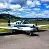
Ragsf15e Posted August 17, 2021 Author Report Posted August 17, 2021 The smoke in California, Nevada, Oregon and Washington is really bad right now. There was actually ash covering the airplane on the ramp in Carson city this morning. I flew from Carson city Nevada to Spokane Washington today. Roughly direct (actually over KGCD and KALW) which is basically the middle of nowhere. It was about 3 miles vis in the smoke. Tops in Nevada were about 12,000’-13,000’ and this is what it looked like all the way around the airplane: Quote
Recommended Posts
Join the conversation
You can post now and register later. If you have an account, sign in now to post with your account.