
.jpg.15c055e2d27d0068519d8e2b98d4cfc3.jpg)
aggiepilot04
-
Posts
216 -
Joined
-
Last visited
Content Type
Profiles
Forums
Blogs
Gallery
Downloads
Media Demo
Events
Everything posted by aggiepilot04
-
You can probably see lots of Mooney models at Fort Worth Alliance the weekend of June 1st. There's a MAPA Pilot Proficiency Program that weekend. I'll be there and would be glad to show you the Acclaim. My kids are 5 and 7, and the long body works great...especially when you have bulky, lightweight items (i.e. Christmas gifts, etc). Eventually though, weight may be an issue for longer hops with the full family + bags...so it depends on your typical mission.
-
The difference in the $100 Garmin card and the more expensive ones is whether or not it comes pre-loaded with data. Just make sure that your Garmin dealer orders the blank card if you already have a fly.garmin.com account. There can't be any difference in a Garmin card and any other retail card...you're paying $88 for a Garmin sticker. I recently paid that though to avoid any legal issues.
-
.thumb.jpg.3b7e6053543e5b3f345615b9eb4a086e.jpg)
Mountain Flying and Winds Aloft Discrepancies
aggiepilot04 replied to aggiepilot04's topic in General Mooney Talk
Thanks for the info. I understand most of that at a conceptual level, and I have read the Mountain Flying Bible. While I don't have much experience mountain flying, I do understand how to take the wind direction and try to visualize how it flows around the mountains. I *think* I can derive where the updrafts/downdrafts may be present based on that, but I don't have the experience yet to know for sure what I'm visualizing is accurate because I've never found myself in a downdraft. I guess what I'm asking is for a real example with real numbers of when you would make a no-go decision solo, and when you'd make a no-go decision for passenger comfort (I had a buddy with me yesterday who was clearly uncomfortable in light turbulence, so that made my decision somewhat easier). And if it's questionable/marginal (say, exactly 25kts), would you start into the mountains anyways and feel it out? Based on the information that I had, would that be a go or a no-go for you? -
Howdy all, Flatlander here, looking for some advice from some of you frequent mountain flyers. I've flown into the mountains a handful of times (Leadville, Granby, Gunnison, Steamboat), and I've also diverted into Denver a few times. All of these have been very easy go/no go decisions though....conditions were pristine (VFR with calm winds) or a death trap (ifr + icing + windy). Yesterday, however, I was trying to get into Kremmling, and the decision was much more difficult. An early morning brief forecasted 7kt winds at 12,000 ft at the time of my arrival. En route, the G1000 (XM) was showing 45kt + winds at 12,000 ft. ADS-B on my phone (Garmin Pilot/GTX345) was showing 22kt winds at 12,000 ft, and, for some reason, winds aloft were unavailable on my iPad. AWOS reporting at various passes/peaks varied from 7kts at some locations to 27G41 at others. AWOS at Kremmling was reporting 11G17 (30 degrees off centerline, if I remember correctly). There were no PIREPs relevant to my route of flight at the time. With each handoff between controllers, I requested ride reports...and no one was complaining up until my last handoff. Ultimately, I decided to divert to BJC for 2 reasons: 1) I didn't like what the ride was starting to feel like at FL180 approaching the mountains and 2) a 737 had just reported moderate turbulence climbing through 17,000 out of Denver. The turbulence that I encountered was light, but I still had the sensation of being tossed about like a kite despite the pitch/roll changes being very slight. Anyways, point being, I have several questions/takeaways from yesterday's flight...in no particular order: I need to better understand the sources of the data that I have in the cockpit and why they could vary so significantly. While I think I have enough basic knowledge and understanding of mountain flying to safely complete a flight in pristine conditions, I need some time in the cockpit with a mountain instructor to be better equipped to make decisions in more marginal conditions. I'm likely losing some of the utility of the airplane by making no go decisions that are too conservative. I would like to better understand how some of you more experienced mountain flyers use the available weather products to make your go/no go decisions. Any practical/real world examples that you can provide would be helpful. Has anyone else seen such significant differences in winds aloft information? Obviously some of the data on the G1000 is interpolated, but I still don't understand why it could vary as much as it did. Thanks in advance.
-
If the Apple Pencil worked with the iPad mini, I’d be all over it. Sent from my iPhone using Tapatalk
-
I have the same problem....Garmin Pilot checklists are flaky. Checklists and checklist items re-order themselves, and it's a pain in the arse. Also, in my opinion, using checklists in the G1000 is not practical (maybe other MFDs are better?). There are checklist items on the MFD that would require toggling between screens. Because of this, I'm still on paper for checklists (and for copying IFR clearances...because using scratchpad sucks).
-
Thought experiment... what’s the step up model?
aggiepilot04 replied to bradp's topic in General Mooney Talk
For what it's worth, my kids are almost 4 and 6, and they do ok on oxygen. They're like their mother though...generally asleep before we ever leave the ground. For the multi-leg trips, a tablet plugged into their headsets keeps them still. I stay out of the flight levels when they're on board and have my wife occasionally check them with a pulse oximeter. -
Had a problem starting today
aggiepilot04 replied to Todd Cullen's topic in Modern Mooney Discussion
Watch the Dmax video that I attached. He explains it in detail. -
Had a problem starting today
aggiepilot04 replied to Todd Cullen's topic in Modern Mooney Discussion
-
Had a problem starting today
aggiepilot04 replied to Todd Cullen's topic in Modern Mooney Discussion
Don Maxwell has a great video on YouTube for hot starting the IO360. Hot starts were a breeze in my J model following those procedures. -
My coldest flight to date was yesterday departing the Chicago area. The cabin heat did not keep up (as you can tell from my daughter hiding under her ski jacket). It finally caught up as the OAT increased to about -10C further south. The friendly folks at Gary Jet Center (KGYY) were very accommodating though. I was able to preflight, load the bags, strap the kids in, and even strap myself in while still in the heated hangar with the door closed. Probably the best service and facilities that I've experienced to date, and the prices were relatively reasonable.

-
If you could somehow route your relief tube to the leading edges, you wouldn't need TKS or RainX.
-
Best Aviation Christmas Gifts
aggiepilot04 replied to Rick Junkin's topic in Miscellaneous Aviation Talk
The best gifts are Mooney gifts. Unfortunately, one of my favorites experienced a prop strike a couple of years ago (because toddlers). Love the ornament too, but I’ll love it more once my wife matches my paint job. Sent from my iPhone using Tapatalk -
What the 430 can do that the iPad can't
aggiepilot04 replied to 201er's topic in Miscellaneous Aviation Talk
People use Apple maps?!? -
I’m shooting for that one as well because it’s a short hop and I have a bfr due next Oct anyways. Maybe I’ll see you there! Sent from my iPhone using Tapatalk
-
I just asked about the 2018 PPP schedule last week. Here are the dates/locations. February 9-11, 2018 - Palm Coast, FL April 13-15, 2018 - Henderson, NV June , 2018 - TBD (possibly in Fort Worth, TX) September 7-9, 2018 - Manchester, NH October 5-7, 2018 - Owensboro, KY Sent from my iPhone using Tapatalk
-
Aviation App Update Download Times
aggiepilot04 replied to KLRDMD's topic in Avionics/Panel Discussion
The Garmin android app doesn’t have all of the same planning features as the iOS app. Make sure you research that first. I tried to switch to Android and found myself back on iOS for that reason. -
I fortunately have not had to deal with this. My wife will not let me fly the kids without her on board, but that’s the extent of the pushback I get on flying. She has seen me cancel or delay flights (regardless of pressure to be somewhere) for almost a decade now though, so I think that will eventually change. That being said, I think the advice above is solid. Build some time and experience and talk them through your decision-making process. If that doesn’t change their minds, fly anyways. I think they’ll come around once they realize they’ll get more time with their daughter. Good luck.
-
Aviation App Update Download Times
aggiepilot04 replied to KLRDMD's topic in Avionics/Panel Discussion
I’ve never timed it, but Garmin Pilot takes forever. I’m on google fiber, so my connection speed is not the issue. It’s either the server bandwidth or the install time. The app in general is very sluggish...so I’m considering going back to foreflight once my subscription expires. -
That is absurd. I'll shoot you a PM.
-
I’d switch back to ForeFlight for that feature.
-
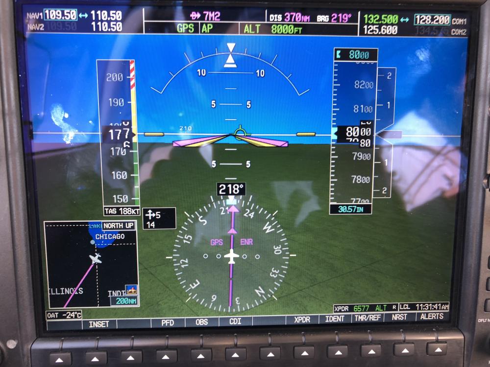
Hah...I normally don't push her that hard. I had a buddy with me and was showing him what she could do. I think I was burning about 20gph in this picture. You got it. I've had the Acclaim for about a year, and you're one of two people that have made that connection. Thanks everyone else for the info and suggestions. I will follow up here once I figure out what's going on.
-
I am seeing some strange G1000 behavior following my GTX345R install and G1000 software upgrade. In retrospect, I should have done these things separately so that troubleshooting would be easier. Most commonly, I get the "AHRS GPS - AHRS1 not receiving backup GPS Information". That seems to occur at least once per flight. But on my last flight, I saw several different messages, and synthetic vision flipped on and off. I was able to resolve it by resetting the GPS 1 and GPS2 circuit breakers (when in doubt, reboot it?!). Video and pictures attached. Has anyone else seen this behavior? VID_20171028_181235.mp4


-
I think the point is that it's easy enough to get down from 17k without a backup plan (assuming the problem is detected reasonably quickly). That chart shows 30 mins + of useful consciousness, and you're looking at 5 mins tops to get down to thicker air.
-
There's no avionics master on the Acclaim, but I generally leave the alternator and A/P off before startup and turn them off before shutdown. From what I've been told, the newer avionics are much more tolerant to voltage fluctuations...so this probably isn't helping anything. For me, it's more out of habit since I had an Avionics master on my J (and it can't really hurt anything). However, do not switch batteries with the engine/alternator on...you'll find yourself replacing an expensive relay. Learned that the hard way.


