marcusku Posted August 23, 2019 Report Posted August 23, 2019 Next Friday we leave for a trip from Wisconsin to Whitefish MO. Being from WI I don't have any mountain flying training or experience and I'm trying to decide whether to fly into Glacier Park (GPI) or land short in Cut Bank (CTB) and drive the rest of the way. Looks like the mountains are lower to the south but still mountains none the less. I'd be on an IFR plan, looks like the min altitudes are fairly high in that area. Anyone else been in the area and have some advice? Quote
gsxrpilot Posted August 23, 2019 Report Posted August 23, 2019 I've flown into Kalispel, (Glacier Park) in my M20C. It's a super easy airport in a huge valley with lots of room. I certainly wouldn't land short and drive. Stay nice and high in your J and you'll be fine. You'll only be over the mountains for about 10 minutes and the view is spectacular. The highest peaks on that route are only in the 9000 ft range. So even at 12,000 you'll be plenty clear of everything. In fact, you'll be on descent into Kalispel before you know it. I'd be tempted to cancel IFR around CTB and go the rest of the way with Flight Following. That way you have more freedom to go where you want to go. Don't miss those views from the air. And Kalispel is a really good airport. Quote
Bob - S50 Posted August 23, 2019 Report Posted August 23, 2019 (edited) If you follow Interstate 90 from Billings (BIL) to Missoula (MSO) it's very doable. I've done that in my J and once you get to Livingston (LVM) the views are beautiful. The highest pass is just east of Butte (BTM). I've never done it, but it looks like more or less following V231 north out of there to Kalispell (S27 or GPI) should be pretty easy. Have fun. Edited August 23, 2019 by Bob - S50 spelling 1 Quote
MooneyMitch Posted August 23, 2019 Report Posted August 23, 2019 While in the Glacier area, and the opportunity presents itself, and skies are clear over the park, I highly recommend a flight directly over the mountainous park! I believe Glacier is one of our few national parks with no altitude restrictions. I could be wrong. The views are incredibly spectacular looking down into the mountain peaks! Absolutely spectacular!!!! Enjoy your upcoming adventures! 1 Quote
PaulM Posted August 23, 2019 Report Posted August 23, 2019 MEA is about 11.5 on V556. We went straight over at 12K IFR direct to KGPI. 10K VFR is an easy route along the south of the park road though the Marias pass to west glaicier. This would be a light wind path. Otherwise I have flown a J through the Rodgers pass. (SW of great falls) Glacier isn't Colorado. There aren't plenty of 14K peaks... In a 172 we stopped at Cut Bank and drove , since we had a hard time in August getting above 10.5 at max gross.. In the Mooney we just went right over. 12K or so, plenty of extra height. Quote
FoxMike Posted August 23, 2019 Report Posted August 23, 2019 Do not want to complicate your planning but consider that you or one of your passengers might not feel well due to lack of oxygen. If that becomes the case you might want to fly lower but not too low, stay well above the peaks. A second consideration is turbulence. I always hand fly in the bumps as the autopilot servos get overworked. Passenger comfort and anxiety is a problem. Unless you can reach cloud tops you are stuck with the bumps (unlikely without Ox). Very unlikely the Mooney will break no matter how bad the ride is but passengers will not believe this. Flying early is best defense against bumps. One other problem is if in clouds at altitude you might encounter some ice. I wouldn't be overly concerned about these hazards but a little thought before you go is worthwhile. Quote
Bob_Belville Posted August 23, 2019 Report Posted August 23, 2019 I’m based in NC and file IFR virtually always but when I toured the West a few weeks ago after Oshkosh from KCUT all the way around to KPWA I stayed VFR with Flight Following. I had no interest in going IMC in those mountains. This route should work at 10500’ or even 8500’ following the pass through the mountains that are not a lot a lot higher than our NC Appalachians. Sent from my iPad using Tapatalk 2 Quote
kmyfm20s Posted August 24, 2019 Report Posted August 24, 2019 I don’t fly IFR flight plans over mountainous terrain unless I’m only going to be in and out of little puffy white clouds. For the most part it’s not going to be the most favorable route and will take you far out of your way. I fly best altitude to glide to roads, lakes and survivable landing areas. Sometimes that’s a 1000 feet above a road or 17.5 MSL. Just watch your DA on take off and winds aloft. Anything more than 22 kts at the mountain peaks it going to get pretty bumpy. 1 Quote
kpaul Posted August 24, 2019 Report Posted August 24, 2019 10 hours ago, marcusku said: Next Friday we leave for a trip from Wisconsin to Whitefish MO. Being from WI I don't have any mountain flying training or experience and I'm trying to decide whether to fly into Glacier Park (GPI) or land short in Cut Bank (CTB) and drive the rest of the way. Looks like the mountains are lower to the south but still mountains none the less. I'd be on an IFR plan, looks like the min altitudes are fairly high in that area. Anyone else been in the area and have some advice? Don't worry there are no mountains in MO. That is the abbreviation for Missouri. Now western MT aka Montana has a few. I grew up flying in Montana and have had my M20F up there. You don't want to land in Cut Bank, you will miss all of the views landing east of the mountains. Fly in the morning and on VMC days. 1 Quote
marcusku Posted August 24, 2019 Author Report Posted August 24, 2019 Oops, yes wrong abbreviation, meant MT. Sounds like canceling IFR and doing flight following might be the way to go. If I need to stay IFR because of some puffys, since I'll be coming from the SW I was considering this route or something along those lines: One the way in it will be tough to go through early in the morning, probably more like mid-morning. When does it typically get bumpy? Quote
Bob_Belville Posted August 24, 2019 Report Posted August 24, 2019 I doubt that you’ll have a problem with turbulence unless the winds are pretty strong, the terrain there does not appear to be anything like flying around the 14 plusers in CO or the Sierra Nevadas. But KP and our western flyers can better advise. Sent from my iPad using Tapatalk Quote
TTaylor Posted August 25, 2019 Report Posted August 25, 2019 21 hours ago, marcusku said: Oops, yes wrong abbreviation, meant MT. Sounds like canceling IFR and doing flight following might be the way to go. If I need to stay IFR because of some puffys, since I'll be coming from the SW I was considering this route or something along those lines: One the way in it will be tough to go through early in the morning, probably more like mid-morning. When does it typically get bumpy? This will work, but is excessive for this time of year and for the relatively low mountains around this area (Under 10,000 feet is pretty low for the Mooney). I would likely plan direct to Ferndale (53U) from your previous fuel stop, then angle north about 10 miles short of Ferndale to Glacier as you start descending. I would fly the leg with VFR flight following climbing to 12,500 as you reach the mountains just northwest of Choteau (8,500 is plenty high until you get to the mountains). This route will put you between Schafer (8U2) and Spotted Bear (8U4) as bailouts as well as Hungry Horse Reservoir for an emergency. This should keep you in reach of a field or lake at all times that would be survivable if you have any issues. You would also spend much less total time over the mountains than your plan above. Tim Quote
TTaylor Posted August 25, 2019 Report Posted August 25, 2019 An other option that minimizes time over mountains and is shorter than your original: Quote
kpaul Posted August 25, 2019 Report Posted August 25, 2019 23 hours ago, marcusku said: Oops, yes wrong abbreviation, meant MT. Sounds like canceling IFR and doing flight following might be the way to go. If I need to stay IFR because of some puffys, since I'll be coming from the SW I was considering this route or something along those lines: One the way in it will be tough to go through early in the morning, probably more like mid-morning. When does it typically get bumpy? I know you are just in the planning stages, however this map is showing you departing from Malmstrom AFB (KGFA) make sure you plan on using Great Falls (KGTF). Air Force Security Forces have NO sense of humor. Your routing there would work if you "needed" to be IFR. Generally, early mornings are best, you just want to be ahead of the thermal heating of the afternoons. I flew gliders a few times out of KGPI and you can do some pretty descent thermaling and ridge soaring in the afternoons. If you departed from Cut Bank (KCTB) as you previously mentioned. I would just climb to 10.5 or 12.5 and plan to cross the mountains over Marias Pass. It is the shortest distance across the mountains. Its only about a 40 minute flight to KGPI. If you are nervous, stick close to the highways - fly IFRRR - I Follow Roads, Rivers and Railroads. South of Marias Pass is the Big Bear and Bob Marshall wildernesses. Its pretty inhospitable, although a beautiful place to do some back country backpacking. 2 Quote
marcusku Posted August 30, 2019 Author Report Posted August 30, 2019 Appreciate all the insight. The plan will be to leave LSE tomorrow early afternoon and see how far west we can get before it gets dark. At a minimum, MLS otherwise possibly GTF or LWT. Then Saturday morning head out the rest of the way to GPI. If we leave from MLS it will probably closer to 10:00 AM when we go over the mountains, hopefully that's early enough. Right now the weather looks clear and winds on the ground will be very light. Forecast winds at 9k don't go that far out but seem to be trending up towards 20 kts. If winds are calm on the ground but 20 kts higher up is that a recipe for some rough riding? Quote
gsxrpilot Posted August 30, 2019 Report Posted August 30, 2019 41 minutes ago, marcusku said: Appreciate all the insight. The plan will be to leave LSE tomorrow early afternoon and see how far west we can get before it gets dark. At a minimum, MLS otherwise possibly GTF or LWT. Then Saturday morning head out the rest of the way to GPI. If we leave from MLS it will probably closer to 10:00 AM when we go over the mountains, hopefully that's early enough. Right now the weather looks clear and winds on the ground will be very light. Forecast winds at 9k don't go that far out but seem to be trending up towards 20 kts. If winds are calm on the ground but 20 kts higher up is that a recipe for some rough riding? That sounds like a fine plan. And 20 kt wind at the peaks is not a big deal. Put a couple of thousand feet between you and the peaks and you won't even notice it. Just enjoy the view. It will be spectacular! 1 Quote
chrisk Posted August 30, 2019 Report Posted August 30, 2019 I was at KGPI 2 weeks ago. The mountains are not bad and you should have no problems getting over them in a J. The airport is super easy and you will have no issues. Do check the icing forecasts. When I went to leave, it seemed like the entire state had an icing forecast that started at the MEAs and kept going up. Quote
gsxrpilot Posted August 30, 2019 Report Posted August 30, 2019 34 minutes ago, chrisk said: I was at KGPI 2 weeks ago. The mountains are not bad and you should have no problems getting over them in a J. The airport is super easy and you will have no issues. Do check the icing forecasts. When I went to leave, it seemed like the entire state had an icing forecast that started at the MEAs and kept going up. I would be very hesitant to fly in clouds and mountains at the same time... especially these big Rocky Mountains. 2 Quote
chrisk Posted August 30, 2019 Report Posted August 30, 2019 12 hours ago, gsxrpilot said: I would be very hesitant to fly in clouds and mountains at the same time... especially these big Rocky Mountains. I've heard that many times. Why would you be hesitant to fly in the clouds while in the mountains? You have a turbo. If your flying at 17K, your not going to hit anything. Modern GPS has a moving map and terrain. On the other hand, if your near freezing levels, I too would be very cautious, since your ability to get out of it might be severely limited by terrain. And of course if there are embedded storms you wouldn't want to do it either. That said, as a general rule, I try to avoid flying in the mountains at night or in IMC. I prefer to have as many options as possible at my disposal. On the other hand, I'm not going to sweat a broken layer. 2 Quote
gsxrpilot Posted August 30, 2019 Report Posted August 30, 2019 3 hours ago, chrisk said: I've heard that many times. Why would you be hesitant to fly in the clouds while in the mountains? You have a turbo. If your flying at 17K, your not going to hit anything. Modern GPS has a moving map and terrain. On the other hand, if your near freezing levels, I too would be very cautious, since your ability to get out of it might be severely limited by terrain. And of course if there are embedded storms you wouldn't want to do it either. That said, as a general rule, I try to avoid flying in the mountains at night or in IMC. I prefer to have as many options as possible at my disposal. On the other hand, I'm not going to sweat a broken layer. This is, of course and over simplification, but my limited experience has been that clouds over the big mountains here in the Rockies are typically either very convective or full of ice. You're correct, I'm not worried about the altitude of the peaks, except that there might be little room to get out of the bottom of the clouds. If it's a broken layer, or just puffy clouds, or above freezing, I'm not concerned at all. That just doesn't seem to be the norm around here. 1 Quote
marcusku Posted September 4, 2019 Author Report Posted September 4, 2019 We ended up stopping in LWT then flew flight flight following the rest of the way as suggested. Route was approximately GTF WOKEN ARLEE GPI though rounded off the corners. Flew at 8500 then up to 10500 before I got to WOKEN. Winds were light and the ride was smooth with some great views. There was almost always a spot for an emergency landing except it was overcast below after ARLEE in the valley until closer to GPI. Planning to leave Friday, fingers crossed the weather holds out. Looks like weather may move in. 2 Quote
gsxrpilot Posted September 5, 2019 Report Posted September 5, 2019 4 hours ago, marcusku said: We ended up stopping in LWT then flew flight flight following the rest of the way as suggested. Route was approximately GTF WOKEN ARLEE GPI though rounded off the corners. Flew at 8500 then up to 10500 before I got to WOKEN. Winds were light and the ride was smooth with some great views. There was almost always a spot for an emergency landing except it was overcast below after ARLEE in the valley until closer to GPI. Planning to leave Friday, fingers crossed the weather holds out. Looks like weather may move in. Pictures??? Quote
kmyfm20s Posted September 5, 2019 Report Posted September 5, 2019 It’s always awesome getting a flight under your belt that helps increase your comfort level in new places. Share the pictures! Quote
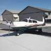
marcusku Posted September 5, 2019 Author Report Posted September 5, 2019 (edited) Here’s a couple. The lake is Flathead. Tricky to upload photos in the right orientation! Edited September 6, 2019 by marcusku 3 Quote
kpaul Posted September 6, 2019 Report Posted September 6, 2019 1 hour ago, marcusku said: Tricky to upload photos in the right orientation! Just upload them, we know a guy around here who has a knack of correcting them. Love to see my home state...only about 10 months until I finally get to move back! 2 Quote
Recommended Posts
Join the conversation
You can post now and register later. If you have an account, sign in now to post with your account.