
rbp
-
Posts
1,308 -
Joined
-
Last visited
-
Days Won
3
Content Type
Profiles
Forums
Blogs
Gallery
Downloads
Events
Store
Everything posted by rbp
-
when I had a bunch of avionics to sell, I created a simple website using squarespace.com and posted links to it with a summary around the web. I got lots of traffic and people actually complimented me on the photos and design.
-
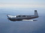
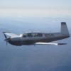
Spotted this pretty C on Thursday at a C&W
-
Would like to ditch my vacuum system
rbp replied to M20 Ogler's topic in Vintage Mooneys (pre-J models)
11. I gained 50# of useful load -
GTN flight plan crossfill to the GNC has arrived
rbp replied to FlySafe's topic in Avionics/Panel Discussion
"This modification is reimbursable under the original Garmin factory warranty." -
it seems that both MAPA and Mooney Summit are understaffed. why not merge the two?
-
yes, you're correct. you can only descend on a published segment of the approach -- a solid black line -- regardless of whether or not you have intercepted the inbound course or GP/GS
-
I managed to find your flight https://flightaware.com/live/flight/map/N202Y/history/20230309/1530Z/KTMB/KTCL here you are intercepting the final approach course 041 @ 8nm from the threshold (You can't see it, but my cursor on the threshold of 04). at 14nm out, you were at 4900' on a heading of 030, and at 10nm out you were at 4400' on a heading of 038, and you only descended 500'. might have also been going faster than you thought. it seems to me that the CDI should have come off the stop further out than 8nm, but you were still pretty high. CAPOG is 11.1nm out, and the crossing altitude is 2400. they definitely did a crappy job of descending you. the should have brought you down to 2400 @CAPOG if you're going to call ATC, then you might want to offer to send them the link for the flight

-
not on vectors to final. you can be established up to +10nm outside the gate (which is 5nm from the threshold) for a non-precision approach, so long as you are navigating on the final approach course these are from JO7110, section 5-9


-
I re-read your post and and I have more questions. you wrote that the glideslope indication appears "at the top of the scale." do you mean it was fully deflected at the top of the instrument? if so, that means you are below the glideslope, not above it. could you have been reading it "upside down?" Where was the CDI at this point? when you say: "I'm not established because they are vectoring me to the final approach coarse outside of the FAF" are you suggesting that with VTF you believe you are not established until you are at the FAF? you are established once the CDI is at half deflection, no matter how far out you are. you may begin your descent once the vertical indicator is half deflected (although its proper for it to be centered), and this should put you at the correct crossing altitude for the FAF.
-
This does seem simpler. Let them worry about getting me to a decent place to start the approach, rather then just on the correct heading. you said you were dodging thunderstorms, which I assumed is why you were being vectored on the FA course and not to ALICE or CAPOG
-
this is in accordance with the regulations, except for the part about needed to be vectored below the glide slope 3nm at 90kts takes 2 minutes, so you would have had to descend at 1100FPM to get from 4,000' to 1,800', which is greater than the recommended 1,000FPM descent rate. Not much you could have done on this approach, but next time you can ask them to vector you at least 4nm out from the gate in order to make a stabilized descent from 4,000 to 1800. -------------------- Maximum Acceptable Descent Rates Operational experience and research have shown that a descent rate of greater than approximately 1,000 fpm is unacceptable during the final stages of an approach (below 1,000 feet AGL). This is due to a human perceptual limitation that is independent of the type of airplane or helicopter. Therefore, the operational practices and techniques must ensure that descent rates greater than 1,000 fpm are not permitted in either the instrument or visual portions of an approach and landing operation.
-
we need fewer mooney type clubs, not more. the leaders of these organizations need to get together and work things out
-
my thoughts from an instrument procedures perspective: if you are being given vectors to final, the vector has to be within a 30 degree angle of the final approach course and must leave you at least 2nm outside the approach gate (which is a point 1nm before the FAF) in low weather. if the weather is at least 500' above the minimums for the approach you've been cleared and 3nm visibility, then you can be vectored inside the 2nm limit but it still must be before the approach gate. At 4000' and 1nm from the FAF, where the crossing altitude is 1800', you have to lose 2200', which is not possible. also, for a precision approach, you must intercept the FA course "at an altitude not above the glideslope/glidepath or below the minimum glideslope/glidepath intercept altitude specified on the approach procedure chart." nevertheless, if you arrive at the FAF with full deflection of the Glide Path (not glide slope), you cannot legally fly the LPV (409' DA) or the LNAV (608' DA), and you are now on an an LNAV (680' MDA). my questions: 1. are you equipped for WAAS approaches? 2. which approach did they actually clear you for? 3. how far outside the FAF did you intercept the final approach course?
-
in IMC? well done
-
So, it’s a user configurable setting, and works fine

-
Yes this FBO had a 135 operation for airplanes
-
yes, CFI/G requires commercial glider! and I flew glider scenic rides with my commercial rating (and no CFI/G)
-
I agree with you. helicopters fly in worse VFR conditions because the Basic VFR minimums are (much) lower and helis often operate off airport and and without airport weather reports. Having a heli instrument rating is academic if you never expect to fly IFR. its not academic when it comes to inadvertent IMC. Unfortunately, it did not help Kobe.
-
Real!
-
Lots of commercial heli operatations are in low ceiling/visibility conditions. Class G Basic VFR for helicopters is 1 mile / clear of clouds. Ask Kobe
-
one of the big benefits of the integrated G3X Garmin EIS is that the log files in the G3X includes *everything*. here is the first row of the CSV file mine produces: Date (yyyy-mm-dd),Time (hh:mm:ss),UTC Time (hh:mm:ss),UTC Offset (hh:mm),Latitude (deg),Longitude (deg),GPS Altitude (ft),GPS Fix Status,GPS Time of Week (sec),GPS Ground Speed (kt),GPS Ground Track (deg),GPS Velocity E (m/sec),GPS Velocity N (m/sec),GPS Velocity U (m/sec),Magnetic Heading (deg),GPS PDOP,GPS Sats,Pressure Altitude (ft),Baro Altitude (ft),Vertical Speed (ft/min),Indicated Airspeed (kt),True Airspeed (kt),Pitch (deg),Roll (deg),Lateral Acceleration (G),Normal Acceleration (G),AOA Cp,AOA,Selected Heading (deg),Selected Altitude (ft),Selected Vertical Speed (ft/min),Selected Airspeed (kt),Baro Setting (inch Hg),NAV Frequency (MHz),Active Nav Source,Nav Annunciation,Nav Identifier,Nav Distance (nm),Nav Bearing (deg),Nav Course (deg),Nav Cross Track Distance (nm),Horizontal CDI Deflection,Horizontal CDI Full Scale (ft),Horizontal CDI Scale,Vertical CDI Deflection,Vertical CDI Full Scale (ft),VNAV CDI Deflection,VNAV Altitude (ft),Autopilot State,Yaw Damper State,FD Lateral Mode,FD Vertical Mode,FD Roll Command (deg),FD Pitch Command (deg),FD Altitude (ft),AP Roll Command (deg),AP Pitch Command (deg),AP VS Command (ft/min),AP Altitude Command (ft),AP Roll Torque (%),AP Pitch Torque (%),AP Pitch Trim Torque (%),YD Torque (%),Magnetic Variation (deg),Outside Air Temp (deg C),Density Altitude (ft),Height Above Ground (ft),Wind Speed (kt),Wind Direction (deg),AHRS Status,AHRS Dev (%),AFCS Attitude Status,Magnetometer Status,Network Status,Oil Temp (deg F),TIT (deg F),Main Fuel L Qty (gal),Main Fuel R Qty (gal),Fuel Press (PSI),Oil Press (PSI),RPM,Manifold Press (inch Hg),Volts,Alt Amps,Fuel Flow (gal/hour),CHT1 (deg F),CHT2 (deg F),CHT3 (deg F),CHT4 (deg F),CHT5 (deg F),CHT6 (deg F),EGT1 (deg F),EGT2 (deg F),EGT3 (deg F),EGT4 (deg F),EGT5 (deg F),EGT6 (deg F),Engine Power (%),CAS Alert,Terrain Alert,Engine 1 Cycle Count
-
"It is not that a Mooney is hard to land, it is that is not quite the same as the aircraft you trained in" fixed it for you
-
I spoke with my heli instructor in Nor Cal. he says there's a heli DPE in VNY that travels. PM me for details
-
when I flew scenic glider rides, I got $18/hour, but that only counted for the length of the flight, which was exactly one hour. i didn’t get paid for training, getting the glider in/out of the hangar, preflight, wx brief, boarding/briefing, etc. if I only had one flight that day, I still had to drive to/from the airport. In reality, it was about $9/hour.
-
i really like flying with john! when i did commercial heli in the 44, we went from SQL across the bay to the SUNOL pass, then south through the valley towards the calavaras reservoir. We were below the ridge line in the valley, so I asked John where the best place to fly down a valley in a helicopter. without missing a beat “where they’re not shooting at you”


