
rbp
-
Posts
1,308 -
Joined
-
Last visited
-
Days Won
3
Content Type
Profiles
Forums
Blogs
Gallery
Downloads
Events
Store
Everything posted by rbp
-
i’ll suggest it.
-
Good suggestion. Which specific parameters?
-
I asked him if he was already on, and he said yes, but I don’t remember his username. His name Is Fred.
-
Lonely at KTGI today
-
Not much to add today, except that on climb out today, I switched from VS to IAS and didn't touch the UP/DOWN thumbwheel. it was pretty steady at +/- 2 knots. As soon as a moved the thumbwheel to adjust the target IAS, the oscillations began.
-
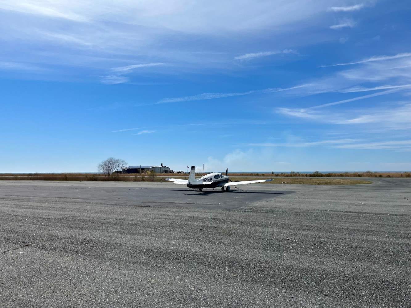
Flew down to Tangier Island (TGI) today to get some crab, however no crab to be had. Needed fuel to make it back, and just 15nm E at Accomack (KFMV) had 100LL @5.30 After I taxied up to the pump, guy comes up and says "hey, I just bought a Mooney!" Check out his beautiful 95 R
-
he is saying the shape and integrity of the parts in the engine is a better indicator of engine wear / life than than recording and analyzing temps and hours. He's right of course -- when the monitoring (or oil analysis) indicates a problem, the problem has already happened, so its only retrospective. then we go in and find out which parts no longer meet the shape and integrity specs set out by the manufacturer, and fix them. And if there are too many parts to fix, we take the engine out and overhaul or get an entirely new one. Where he is wrong, is that we can't easily prospectively examine the requisite parts of the engine which need to be within spec. We can use boroscopes at interval, but no onejust pulls a jug or a cracks a case to see whether the parts meet spec.
-
-
I think he means because there’s not enough oil to move the prop governor
-
LED Replacement for Whelen Model #70303 Light
rbp replied to StevenL757's topic in Avionics / Parts Classifieds
Invoice arrives today. When you have the 28 V lights in hand, I will pay it. -
Thank you
-
For those sitting in the back: “Greater glide distances can be attained by moving the propeller control FULL AFT (LOW RPM).”
-
ISO main gear shock link PN 520010-1
rbp replied to Sean S's topic in Vintage Mooneys (pre-J models)
We should probably develop a community checklist for this -
Spotted yesterday on the ramp at KLDJ Who's visiting my home airport?

-
I went through this last night. it was very informative! The testing procedure is quite straight forward, and I am going to try it this weekend >>>Place the autopilot in IAS/ROL mode commanding a bank angle of zero and an IAS speed that roughly allows the aircraft to hold altitude for the given power setting. Remember to stay below the maneuvering speed of the aircraft (VA). >>>To tune the airspeed gain, allow the aircraft to settle in its steady state, then use the control stick to over-power the servo and displace the aircraft from the desired airspeed. The pilot should pull or push the stick to up or down for roughly one-two seconds to establish a new airspeed, and then release the stick. >>>After releasing the control stick see the AP response by watching the control stick and airspeed indicator. The aircraft should return to the desired airspeed without being too aggressive or lazy.
-
Personal Locator Beacon Recommendations
rbp replied to nfonville's topic in Miscellaneous Aviation Talk
if you're an iPhone user, you could get an iPhone 14 https://support.apple.com/en-us/HT213426 -- "With iPhone 14 and iPhone 14 Pro models, you can use Emergency SOS via satellite to text emergency services when you're out of cellular and Wi-Fi coverage. You can also use the Find My app to share your location with people via satellite." undoubtedly android phones will have this soon enough as well -
check out the G3X installation manual, chapter 10, which has all the info on the GSU 25 ADAHRS https://static.garmincdn.com/pumac/190-01115-01_0K.pdf
-
An AHRD is a solid-state IRU https://en.m.wikipedia.org/wiki/Vibrating_structure_gyroscope#MEMS_gyroscopes
-
so you have the same background, but disagreed when I originally took the position that OP could have descended after turning inbound. looking forward to seeing how you will justify taking both opposite positions, without admitting that one was wrong in one
-
after a discussion with a friend who is a long-time corporate pilot/ATP/CFII, I am reversing my position on this, and here is why. he said many airports that don't have radar coverage low enough to descend you below the MVA to the glideslope/path intercept altitude. so they give you a clearance to maintain the MVA altitude "until established" so that you will intercept the final approach course inside an intermediate fix aligned with the runway. Once you turn inbound, you are actually on an intermediate segment (note the thick black line), which is a published segment of the approach and you can then descend in protected airspace to the altitude at the FAF. in the case of TCL RNAV RWY 4, we know from the ADS-B track that @0TreeLemur intercepted the final approach course at least 8nm from the threshold at 4000, which puts him inside CAPOG (11.1nm), heading 041 (note on the chart that this is specifically the final approach course) for BUPGY, and he can therefore descend in compliance with 91.175(i) to cross at 1800, and capture the glidepath The reason they don't clear you to the IF is because you're talking to TRACON and getting vectors to final, which means they send you to the FAF. If you want to fly the full approach, you have to ask for it, in which case you'd have to go to an IAF, not CAPGY because CAPGY's crossing altitude is below the MVA So, in actuality, @0TreeLemur had at least 3 miles from when he intercepted the final approach course until BUPGY to lose 2200 ft. Still not a great descent rate to capture the glide path, but certainly better. here's another link to the plate:
-
thanks -- I emailed my A&P about this
-
I definitely feel like you + G want this resolved!
-
here’s the site I made https://flamingo-parakeet-cnj9.squarespace.com
-
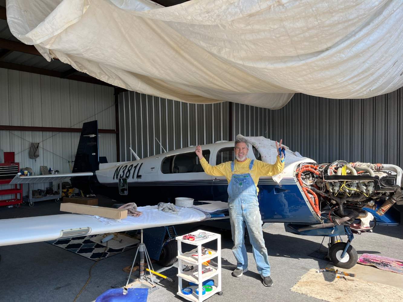
There is no discernible stickiness the shop has inspected and tested and adjusted every thing in the airframe that Garmin has asked for. —— 6. Trouble shoot Garmin GFC500 autopilot for having a pitch oscillation when selected to indicated airspeed mode. Go through Garmin supplied autopilot troubleshooting checklist. Adjust bridal cable tension for roll, pitch and yaw servosto the top ofthe spec. Found leaks in pitot and static systems. Repair leaks in pitot and static system. Confirm addendum gain settings are correct as per Doc. 005-01470-17 Rev. 4. [12 hrs.] 7. Inspect pitot line from mask all along to ADC and G5 connection for blockages or kinks. Inspection of line is OK. [5 hrs.]
-
After having all the mechanicals checked and set to spec, they next step was the pitot/static system IThey inspected and tested the entire static tubing and pitot tubing, and found no blockages, kinks, holes, or anything else. The last possibility was a leak in the gear safety switch, which they disconnected and sealed off so I could test fly it, which I did late last week. The IAS oscillations persist I did try the trick of setting the VS and getting it stabilized and then switching to IAS. because there was so much lift, i kept having to set the ALT bug higher and climb out at 130 (instead of 120). I established a climb at in VS @ 130, and then switch to IAS, which it held +/- 3 knots. then i rolled it down to 125 and 120, and the airspeed oscillations increased both times. Last discussion I had with @TrekLawler was to bring my plane to Garmin, but they are looking for a J or K, not an M at this point in time, I am at a loss as to what to do

