
rbp
-
Posts
1,308 -
Joined
-
Last visited
-
Days Won
3


rbp's Achievements
")


-
Lol. Where did I say it was the cause? I am looking at the torque numbers with and without oscillations.
-
I do know because the data is the logs and have analyzed them. That’s not the problem.
-
Panel and Avionics Upgrade is Scheduled
rbp replied to Pinecone's topic in Avionics/Panel Discussion
If you’re going with the remote transponder, you might as well go with the remote audio panel too. I know there are some people on here who prefer the PS, but I have the Garmin audio and it works just great. I have the audio playback button as one of the soft keys on my gtn750, and it’s super handy when I miss a call -
14 CFR § 91.169 (2) If no instrument approach procedure has been published in part 97 of this chapter and no special instrument approach procedure has been issued by the Administrator to the operator, for the alternate airport, the ceiling and visibility minima are those allowing descent from the MEA, approach, and landing under basic VFR. the way i read this is that if the destination airport has no IAP, you must file a legal alternate did you have an alternate in the original FLP?
-
to be clear, when you are given a clearance, its to the clearance limit in CRAFT. eg, you can file to a VOR where its reported to be VOR
-
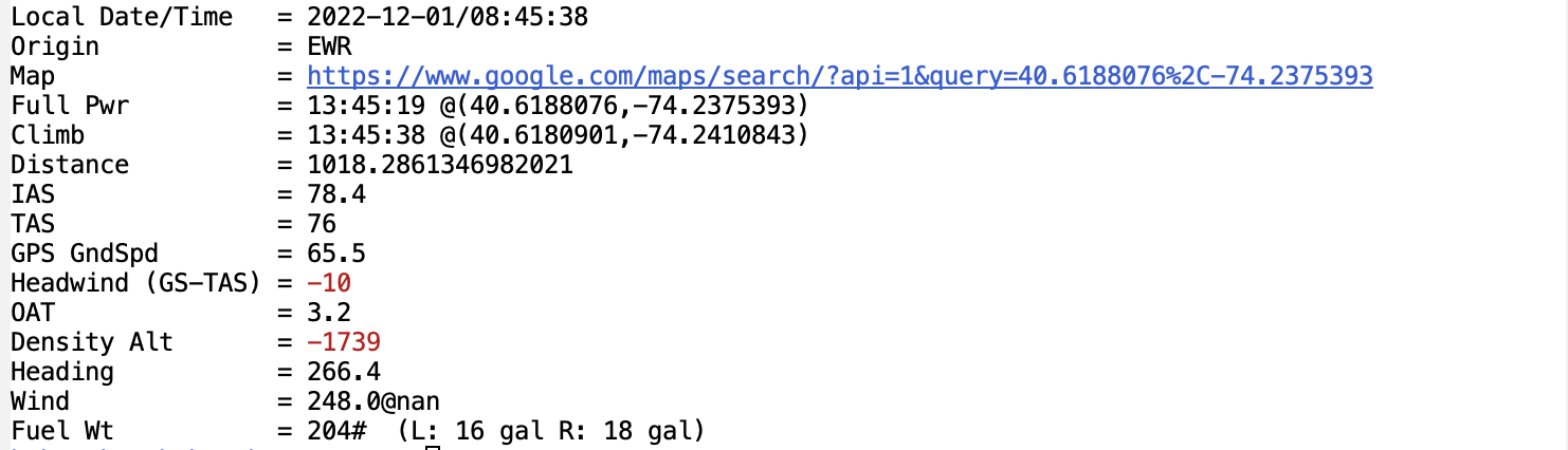
Now calculates head/tailwind, weight of fuel, and a link to the position of the departure
-
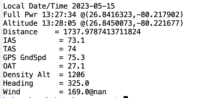
here's another one departing Palm Beach North county with full fuel, 70# of luggage, one soul
-
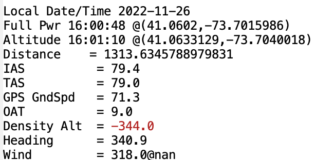
I wrote another program today that looks at the log file and calculates the take off distance for that flight. for example, here's the results from a departure from HPN. Since I almost always put in full power before releasing the brakes, that's how I choose to determine where the beginning of the T/O roll is, and this most closely mirrors what one would do for a short-field takeoff it took 1314 ft the air/data computer hadn't yet calculated the windspeed, so it spits out 'nan', but you can tell that it was about 8kts based on GS - IAS
-
its the other way around. for each combination of power settings (MP, RPM) and altitude, it tells you what TAS you got in that configuration send the logs!
-
when I picked up the plane from the dealer back in 1998, they demonstrated this to me as an innovative way to keep the battery from going dead. did you turn the sound on? you can hear the little generator
-
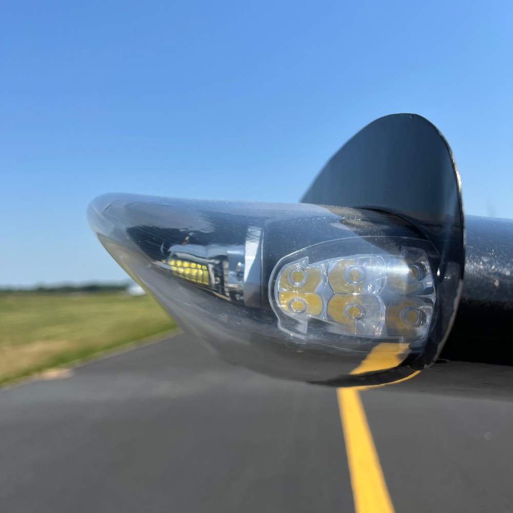
Finally got these installed. turned them on approach back to linden. hope someone saw them!
-
here's a video. can't really see the light, but its getting brighter every time I press
-
IT Guru Needed for Airports With Food Chart
rbp replied to cliffy's topic in Miscellaneous Aviation Talk
I did this one last year for the northeast there really needs to be an map overlay, just like the one for fuel. https://maps.app.goo.gl/oBfqR9fVX7UHAcXLA?g_st=i -
If you have a logs from a Garmin, EIS, I wrote a program to analyze them and show actual performance. I’ve only ever used it with my own logs but I’m happy to try someone else’s.
-
Did you just go for the day? $250 burger?

