Search the Community
Showing results for tags 'icing'.
-
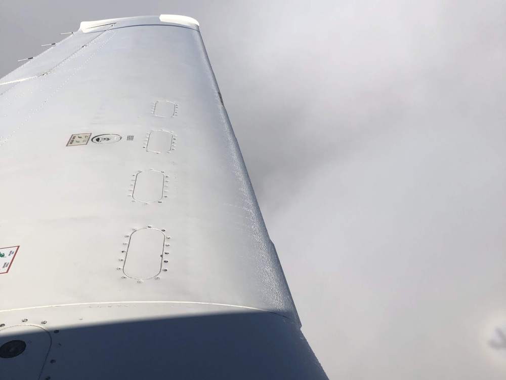
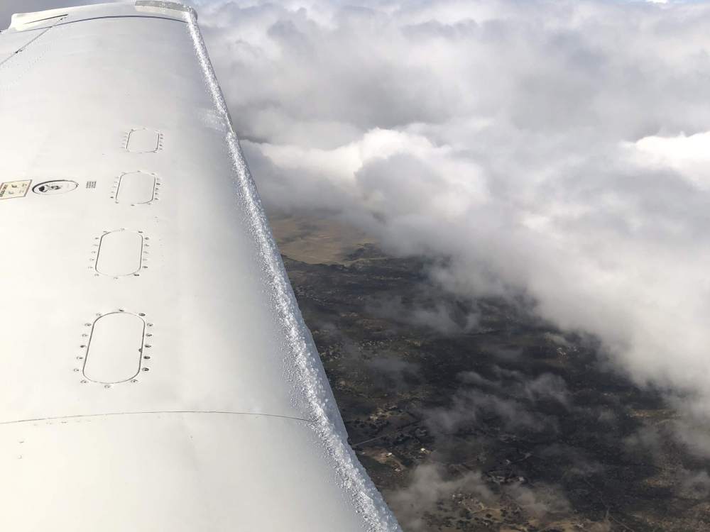
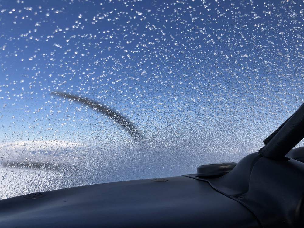
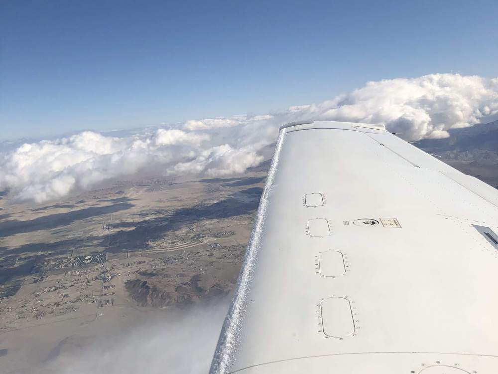
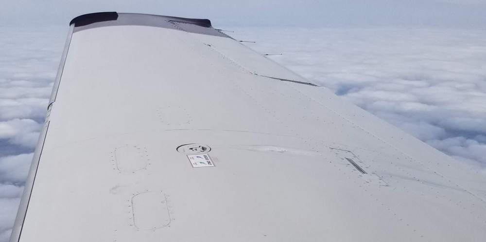
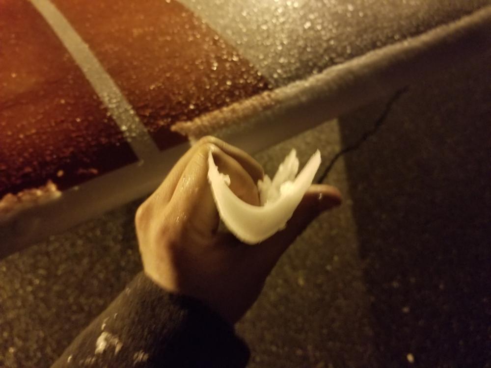
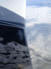
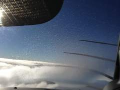
I flew from San Diego to Las Vegas yesterday (1/9) for a meeting I had at CES. I have always heard stories of people getting incredibly rapid buildup of ice over San Diego but in my 20 years of flying have never seen it. As you can see I experienced some ice. I was in and out of the clouds climbing over over Ramona(KRNM) airport to Julian(JLI) VOR. The bottom 2 photos were taken only 4 minutes apart and that much ice collected. Wow!
-
I was coming out of Chicago the other day and temps were in the high single digits in Celcius and after I got through all of the visible moisture I looked out at my right wing and saw this white looking stuff building up behind the apparently now leaking fuel tank cap. Confounded me for a while as I was 100% sure it wasn't there when I left and then I looked back and it was gone. Best I can figure is the moisture coming off the gas cap combined with the evaporation of the fuel dropped the temperature locally enough to freeze what water was there. I just thought it was interesting. Now the fuel tank leaking is a new phenomenon, the line guys did really fill it up and I was able to push the cap down just a tiny smidge after I landed. That was on me, as I did visually check the quantity. I looked the gasket over and nothing looked odd, will just continue to monitor and see if this occurs again. Any advice appreciated. I did lose a couple of gallons I think.
-
Hey guys, Just wanted to share personal experience for the team. Planned a night ifr flight, no forecast or reported icing. I have no anti ice on the m20k so I am pretty cautious about it. In descent started noticing some vibration in the engine. Was in the mountains so I got steped down pretty quick. Vibration went away but wing ice remained. I think most of it built up on the wing in the first few minutes as I entered lower moist but warm air the ice turned from rime into a melted mixed. Of course it was night and the airfield just started to have this mixed precipitation (not for cast) Flying characteristics were actually not too affected. I had about 30 gal of fuel in the wings, 1 pax front seat and about 50 lbs of cargo. I had no issues with full flap landing. Rounding out just below 80kts. Windscreen did start to collect around the middle. The sides were fine and I could see past. Eventually the de fog and warmer temps let it slide right off. Conclusions that I can draw from this are. Don't rely on forecast for icing. The CIP is quite good to be honest and I will be trusting that more in the future. The Canadian gfa really let me down. Rely on atc as they were quite helpful and stepped me down to below the feeder altitude for the RNav. And if ice happens, don't panic. Turn on whateve equipment you have. Get to lower and hopefully she'll melt. In this particular situation I felt that controlability was not an issue. Fly safe!
-
Combating Icing in General Aviation Aircraft BY SARAH ROVNER, MASTER CFI, CFII, MEI, ATP, OWNER OF FULLTHROTTLE AVIATION LLC January 2018 As winter weather reaches the majority of the United States, it brings a unique set of weather phenomena. The colder temperatures and frozen precipitation pose an exceptional threat to general aviation aircraft. Although general aviation aircraft range in size and capability to handle cold weather conditions, careful thought must go into planning when the threat of icing is present. As an international ferry pilot who has flown 115 different aircraft in 15 different countries and taken small aircraft across the North Atlantic to Europe, there are many tools and strategies that I have come to use that many general aviation pilots may benefit from. Icing poses risks to aircraft beyond the loss of control situations that pilots have read about in accident reports. Even small amounts of ice accumulation will degrade aircraft performance significantly. I’ve picked up small amounts of ice climbing through thin clouds, and even a minuscule amount of ice can equate to significant losses of airspeed which eats into fuel reserves. For North Atlantic crossings in most small aircraft, the longest legs are just shy of 700nm between Canada and Greenland, and then Greenland to Iceland. Most of the airplanes I’ve flown across have a range of just slightly more than that with reserves. Therefore, it’s absolutely critical that there is no ice accumulation or there is the risk of running out of fuel before reaching shore. Not all ice will sublimate. When ferrying a King Air across the North Atlantic, I picked up ice while climbing through clouds on the way to Iceland from Greenland. After waiting for the proper amount of ice accumulation, I engaged the de-ice boots but not all ice came off, nor did it come off completely evenly. Just that small accumulation caused a decrease in performance, but luckily the tailwind allowed the flight to continue with sufficient reserves. The ice didn’t come off for the entire 4-hour leg, with temperatures around -40°C (-40°F) at 25,000ft. The dangers of icing and its effect on performance are serious, and pilots should not anticipate that the ice they pick up on the climb will go away once they are clear of clouds. Although not all clouds will cause icing in winter, there is a high probability that a general aviation aircraft will begin to accumulate ice when the temperature drops to around 0°C (32°F) and there is visible moisture present. FAA Advisory Circular 91-74B1 discusses how clouds and visible moisture at temperatures below freezing are often mixed with frozen liquids (super cooled clouds) and ice particles. Ice accumulation is often greatest at temperatures just below freezing where there is a high quantity of liquid water content, and nearly negligible when the temperature is below about -20°C (-4 °F) as most clouds are made up entirely of ice particles. As the temperatures start to get colder, it is critical that pilots ensure they are staying within the operating limitations of their aircraft. Not all piston airplanes can handle the extreme cold, so pilots must consult their aircraft manufacturer for temperature limitations to include pre-heat and engine temperature limitations. Additionally, many general aviation airplanes equipped with TKS systems also have temperature limitations and a specific operating envelope where protection is effective. Ferrying small aircraft for long distances has little to do with flying itself – it’s all about planning. A great tool that many general aviation pilots are not aware of is the GRAMET, which is a graphical vertical flight path weather forecast based on the Global Forecast System. This tool combines prognostic charts, AIRMETS, SIGMETS, winds aloft tables, and many other tools into a graphical representation of weather along a specific flight path and altitude at a specific time. In many cases, pilots are not able to attain a temperature range suitable for operation in clouds due to altitude limitations, so the GRAMET is helpful to get an idea of where the clouds actually are in relation to their path in order to choose a path that would keep them clear of visible moisture in a dangerous temperature range. The Autorouter is a free tool that can generate a GRAMET for pilots by inputting their route and flight plan information, and can be found at:https://www.autorouter.aero.* Although the Autorouter is primarily for European pilots that look for route and flight planning tools, the tool does work for any ICAO airport. By selecting the GRAMET link on the upper right hand side (which does not require an account), a user can input their flight plan information, time and altitude and it will generate a GRAMET immediately. Since the tool is more geared toward Europe, not all North American fixes will be recognized but most airports should be. OGIMET is another tool that can be used to generate a GRAMET and it can be found at http://www.ogimet.com/home.phtml.en.* OGIMET is not as easy to use but it does provide the same data and even has an Android App (but not for iPhone). Icing poses a severe threat to aircraft and can significantly degrade performance and aircraft control. Avoiding icing conditions with a high probabiity of ice accumulation is important for the safe completion of any General Aviation flight. Proper pre-flight planning using all available information and tools is a very important part of icing avoidance. While enjoying the cooler temperatures this winter, make sure you are taking into account all aspects of winter weather while planning your flights. Fly safe this winter and remember that cold weather isn’t to be avoided completely; but it is to be respected. We’d love to know what you think of this PIREP. Please email us atPIREP@Avemco.com and let us know. Reprint by permission only. If you would like to obtain reprint requirements and request permission, please email us at PIREP@Avemco.com 1https://www.faa.gov/documentLibrary/media/Advisory_Circular/AC_91-74B.pdf
-
I live in SC so not a ton of icing problems most of the year and I have zero experience with it other than knowledge of sorts. What exactly are the conditions to avoid for icing? I'm aware of the freezing level, icing forecasts, super cooled droplets, etc. When should you just plan on not going? It seems to me that if the freezing level is at 3k, clouds at 6k with a temp of 25 degrees F or so(or even lower), that whatever is in the clouds should blow around the plane. How do you predict when super cooled droplets exist or not? Do you always avoid clouds in freezing conditions? Hopefully this brings about some good real world pointers that are difficult to read in books.
-
I believe this was a NASA video and its in typical government style so be warned. http://youtu.be/j_D8tcnL2uQ
-
From the album: N252BH
Moderate rime ice on Dec 2 2013 at Fl190 to Fl210 -
From the album: #ScubaMan's album
We encountered our first trace Icing in our Mooney coming back from Vegas today at Flight Level 180.... -
One of the best tools I've ever found for planning cross country flights is one that it seems few people know about. Go to weather.aero, where you'll find an experimental adds site from faa / ncar (national center for atmospheric research). The site is good, but check out the flight path tool under desktop apps. It is a java app that works on mac or pc. The brilliance is that it gives you access to the 3 dimensional current/forecast model of the atmosphere. You put in a route of flight, and you can see VERTICAL cross sections as well as an area view for the weather aspect you choose. If you turn on relative humidity, for instance, you can see where the cloud layers and tops are forecast. It is brilliant. Anyone else been using this? it is the only way I've found to plan long trips particularly where there is imc with chances of icing I'd like to avoid... Greg


