MHemperly Posted January 19, 2017 Report Share Posted January 19, 2017 2 hours ago, RobertGary1 said: Yes. Sometimes. Nothing about rain in the mins. -Robert But there is visibility.... Quote Link to comment Share on other sites More sharing options...
Drumstick Posted January 19, 2017 Report Share Posted January 19, 2017 Weather was abysmal on the 12th. We canceled a ferry flight from Foothills to IYK that day due to weather and both of us are instrument rated. Condolences to the family. 1 Quote Link to comment Share on other sites More sharing options...
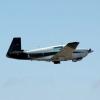
carqwik Posted January 19, 2017 Report Share Posted January 19, 2017 N6201N 1978 M20J RIP Quote Link to comment Share on other sites More sharing options...
SantosDumont Posted January 19, 2017 Report Share Posted January 19, 2017 11 hours ago, RobertGary1 said: It's not really feasible to determine flight weather with much accuracy by driving. Hard rain doesn't stop me from flying. For flying you're looking more at freezing levels, TSs, etc. I've flown through rain that was intense and it's not too big of an issue other than some turb. Even the turb and winds at altitude are going to differ from what is on the ground. Depends on the pilots experience, rating etc. Cant arm chair this fairly from a minivan on the highway. Well I'm just a wet PPL so my personal minimums are if it shows up on radar I ain't going. Local news story about the pilot: http://www.tehachapinews.com/news/missing-local-pilot-reportedly-found-dead-among-wreckage/article_26d4018c-ddc5-11e6-9f59-83a6ec3a629a.html 1 Quote Link to comment Share on other sites More sharing options...
Marauder Posted January 19, 2017 Report Share Posted January 19, 2017 N6201N 1978 M20J RIP Not familiar with the route but looked up FlightAware history on this plane. Only one recorded flight in 2015. Is this the area where the plane went down?Sent from my iPad using Tapatalk Quote Link to comment Share on other sites More sharing options...
flyboy0681 Posted January 19, 2017 Report Share Posted January 19, 2017 Airmen registry has him down as a multi-engine and instrument rated only in SEL . He was also an A&P. Quote Link to comment Share on other sites More sharing options...
jetdriven Posted January 19, 2017 Report Share Posted January 19, 2017 10 hours ago, glenn reynolds said: Jose, while I was on vacation, flying Alaska there was an ongoing search for a missing plane and every time we briefed the briefer asked us to look for the plane. As this went on for three weeks I spoke to lots of folks about elt and far to many made this comment: "elt? Of no use, first thing to break in a crash is the elt antenna and we can't get a signal". The search and rescue guys did however Iike the units like "spot" for two reasons: first even if the transmitter is distroyed searchers know where you were within ten minutes of crash. Second reason, if you and the transmitter survives the crash spot shows any movement and thus rescue efforts roll as opossed to recover efforts. Our next Alaska trip will use one of the spot like units Spot locator is not reliable. The 406 PLB units are. Also, if you mount the ELt antenna under the fiberglass dorsal fin it has quite a bit more protection 1 Quote Link to comment Share on other sites More sharing options...
RobertGary1 Posted January 19, 2017 Report Share Posted January 19, 2017 3 hours ago, mooniac15u said: That's right but visibility does matter and @SantosDumont told us about low visibility due to the hard rain. Very difficult to determine flight visibility on the ground. We've all been flying around at times with local reports at mins while we're CAVU at attitude. Not really enough evidence in my book to convict a dead brother. That's why NTSB investigations take 6-12 months. -Robert Quote Link to comment Share on other sites More sharing options...
RobertGary1 Posted January 19, 2017 Report Share Posted January 19, 2017 CAP went up the night before and were unable to locate the ELT. The next day CAP was able to discover the wreckage and coordinated a sheriffs helicopter. -Robert Quote Link to comment Share on other sites More sharing options...
SantosDumont Posted January 19, 2017 Report Share Posted January 19, 2017 (edited) News article says near the intersection of Pine Canyon and Forrest Route which would be about here. In the LiveATC recording he calls left downwind departure at 1650. METARs from KWJF (9 miles away) at the time (1656 UTC) say it was OVC024 which is too low to get over those hills at about 4500. Edited January 19, 2017 by SantosDumont Quote Link to comment Share on other sites More sharing options...
TTaylor Posted January 19, 2017 Report Share Posted January 19, 2017 10 hours ago, NotarPilot said: I'm asking the wife for a PLB for my birthday. I fly with a satellite tracking (Spot) on almost all flights. I always have someone tracking my flight or knows how to check my track if I am late. The Spot does have regular tracking (I use 10 minute intervals) and emergency signals that will alert authorities if activated. 1800wxbrief.com now allows you to include the tracking in your profile so that when using a flight plan they can check your progress. I pay $150 per year for the tracking service and use the Spot in my plane and glider. It is great to be able to tell someone they can track your flight to know when you will arrive and meet you at the airport and the peace of mind is worth the money. 2 Quote Link to comment Share on other sites More sharing options...
jaylw314 Posted January 19, 2017 Report Share Posted January 19, 2017 15 minutes ago, SantosDumont said: News article says near the intersection of Pine Canyon and Forrest Route which would be about here. I used to drive Pine Canyon Rd like a madman in a WRX in my younger and dummer days. I shudder to think what would have happened if I had gone off the road then because it is so remote--I never saw another car in all the times I drove it. 1 Quote Link to comment Share on other sites More sharing options...
RobertGary1 Posted January 19, 2017 Report Share Posted January 19, 2017 1 minute ago, TTaylor said: I fly with a satellite tracking (Spot) on almost all flights. I always have someone tracking my flight or knows how to check my track if I am late. The Spot does have regular tracking (I use 10 minute intervals) and emergency signals that will alert authorities if activated. 1800wxbrief.com now allows you to include the tracking in your profile so that when using a flight plan they can check your progress. I pay $150 per year for the tracking service and use the Spot in my plane and glider. It is great to be able to tell someone they can track your flight to know when you will arrive and meet you at the airport and the peace of mind is worth the money. when I was flying in Mexico a lot I used SPOT as well. It really does work well. We've had a few planes go down in Mexico and the search area was an expected flight path over 100 miles. Never found any of them. People used to criticize me for using it given the worst case scenario of going down just before the next ping but its better than nothing. Although I'm considering 406 now which would probably help. -Robert Quote Link to comment Share on other sites More sharing options...
SantosDumont Posted January 19, 2017 Report Share Posted January 19, 2017 11 minutes ago, TTaylor said: I fly with a satellite tracking (Spot) on almost all flights. I always have someone tracking my flight or knows how to check my track if I am late. The Spot does have regular tracking (I use 10 minute intervals) and emergency signals that will alert authorities if activated. 1800wxbrief.com now allows you to include the tracking in your profile so that when using a flight plan they can check your progress. I pay $150 per year for the tracking service and use the Spot in my plane and glider. It is great to be able to tell someone they can track your flight to know when you will arrive and meet you at the airport and the peace of mind is worth the money. $150 seems like a great deal for that service. I'm confused what the difference is though between the Unlimited service and the Extreme service upgrades are. Quote Link to comment Share on other sites More sharing options...
gsxrpilot Posted January 19, 2017 Report Share Posted January 19, 2017 I've been a spot customer since 2011. Initially it was so my chase vehicle could find me after long cross country flights in the hang glider. I use it now in the Mooney so my wife can check if I'm overdue, or landed but phone's dead and I can't call immediately. It's peace of mind. Quote Link to comment Share on other sites More sharing options...
TTaylor Posted January 19, 2017 Report Share Posted January 19, 2017 49 minutes ago, SantosDumont said: $150 seems like a great deal for that service. I'm confused what the difference is though between the Unlimited service and the Extreme service upgrades are. The basic service is tracking every 10 minutes. Unlimited Tracking - SPOT Gen3's new enhanced tracking options allow you to "set it and forget it." Send track messages every 5, 10, 30 or 60 minutes for as long as your SPOT is powered on or until the batteries run out. Extreme Tracking - Send track messages every 2.5 minutes for as long as your SPOT is powered on or until the batteries run out. Quote Link to comment Share on other sites More sharing options...
jetdriven Posted January 19, 2017 Report Share Posted January 19, 2017 But the spot is not a life saving device. They clearly state that. There are times it won't see satellites or it can't connect 1 Quote Link to comment Share on other sites More sharing options...
TTaylor Posted January 19, 2017 Report Share Posted January 19, 2017 4 hours ago, jetdriven said: Spot locator is not reliable. The 406 PLB units are. Also, if you mount the ELt antenna under the fiberglass dorsal fin it has quite a bit more protection On what evidence do you have that Spot locators are not reliable? I have flown with one for nearly 10 years and fly many competitions each year where as many as 40 other gliders have them. The tracking function helps to pinpoint the location to within a few miles even if the unit does not survive the crash. A PLB only is helpful if it goes-off and/or can be activated. There is no history of where it was if it does not work or is destroyed in the crash or is covered so it can't send an alert. While I think PLB's are great, unless you have some solid evidence please don't make a claim like "not reliable". The best tracker on the market currently is probably the DeLorme InReach but I still like the Spot. Both trackers provide much more information for 99% of the time compared to a PLB. Quote Link to comment Share on other sites More sharing options...
kortopates Posted January 19, 2017 Report Share Posted January 19, 2017 (edited) 11 hours ago, takair said: Paul i'm feeling pretty ignorant right now reference activating AND cancelling flight plan via iPhone. I understand filing via ForeFlight, but have to admit I've never thought about the opening and closing part. At my old airport, it was almost automatic to have flight following, but at my current airport it is more of a chore. Would you mind pointing me in the right direction...perhaps I'm not the only one unaware of this. Thanks... 6 hours ago, Skates97 said: I don't know what it is like there now, but we lived there from 1980-84 and my dad flew HC-130's out of Elmendorf with the Air Rescue Squadron (before the Coast Guard took over Search and Rescue stuff). He's told many stories about searches for downed planes, hearing the ELT, and making multiple passes over the area until they found it. Without the ELT they never would have found the plane. He just recently finished reading a book called "Looking for Alaska" and in it the writer talks about a plane wreckage up on the side of a mountain in Miller's Pass. My dad was flying a training mission through Miller's Pass when they heard an ELT. They made multiple runs up and down the pass looking in the bottom before noticing the plane up on the side of the mountain. They called in the helicopters and PJ's and the pilot was saved. Without the ELT that pilot would have died up there, nobody was even looking for him at the time. Of course back then there wasn't any technology like the spot units. I'm all for using every bit of technology there is available. Not sure what Paul uses, but if you sign up and file it on www.1800wxbrief.com you have the option of opening and closing a flight plan through text or email. I have an Android tablet and use DroidEFB which will send my plan to 1800wxbrief.com, I don't know about Apple and Foreflight but I would assume that it integrates as well. You can sign up for alerts about your route and get them sent via email or text. You also will get an email/text prior to your planned departure time with a hotlink in it that you can click to activate and then close your flight plan. It's a pretty cool service. Yes, I was referring to https://www.1800wxbrief.com and Skates97 nailed it. One just needs to go to their site, register, set up notification preferences and then when they file a VFR flight plan through LM, they will get the email or text msg's to activate and close their Flightplans. I don't know if this has been integrated into Foreflight. It isn't yet in Garmin Pilot or WingsX. So when it comes to filing VFR flight plans, which frankly isn't that much for me except working with primary students, I go directly to LM. But IMO this is too good of a feature to miss out on from being inconvenienced by not being able to file from my favorite ipad app. In the busy airspace I fly, trying to get a Flight plan opened before talking to SOCAL to get class B clearance actually alters my flight path. Opening and closing right on the runway is very slick. Edited January 19, 2017 by kortopates 1 Quote Link to comment Share on other sites More sharing options...
Guest Posted January 19, 2017 Report Share Posted January 19, 2017 Many years ago a friend was lost on a flight from Vancouver Island to Calgary. ELT was heard for a short time but no wreckage was ever located, many hours spent by SAR, both military and private to no avail. 12 years later a hiker found the wreckage and remains, bringing closure for his family. A better ELT and a PLB may have saved him. Clarence Quote Link to comment Share on other sites More sharing options...
mccdeuce Posted January 19, 2017 Report Share Posted January 19, 2017 15 hours ago, glenn reynolds said: Jose, while I was on vacation, flying Alaska there was an ongoing search for a missing plane and every time we briefed the briefer asked us to look for the plane. As this went on for three weeks I spoke to lots of folks about elt and far to many made this comment: "elt? Of no use, first thing to break in a crash is the elt antenna and we can't get a signal". The search and rescue guys did however Iike the units like "spot" for two reasons: first even if the transmitter is distroyed searchers know where you were within ten minutes of crash. Second reason, if you and the transmitter survives the crash spot shows any movement and thus rescue efforts roll as opossed to recover efforts. Our next Alaska trip will use one of the spot like units I fly SAR. I fly with a SPOT both professionally and privately. It just makes sense. The newer beacons out there work ok even with no antenna but it sure is nice to know someone pushed a button. I also fly with a laser flare. No pyro and lasts a lot longer. http://www.greatlandlaser.com 1 Quote Link to comment Share on other sites More sharing options...
TTaylor Posted January 19, 2017 Report Share Posted January 19, 2017 3 minutes ago, bluehighwayflyer said: Yes, life insurance policies are readily available without the PPL exclusion. In my case, though, the premium was roughly double. I have no idea if that is the case for everyone, however. Also, you need to check not only if it covers flight but standard airworthiness versus experimental or racing catagory. Mine is good for all aircraft. Was not that much higher than regular. My wife appreciates that I have it. Quote Link to comment Share on other sites More sharing options...
mccdeuce Posted January 19, 2017 Report Share Posted January 19, 2017 29 minutes ago, kortopates said: Yes, I was referring to https://www.1800wxbrief.com and Skates97 nailed it. One just needs to go to their site, register, set up notification preferences and then when they file a VFR flight plan through LM, they will get the email or text msg's to activate and close their Flightplans. I don't know if this has been integrated into Foreflight. It isn't yet in Garmin Pilot or WingsX. So when it comes to filing VFR flight plans, which frankly isn't that much for me except working with primary students, I go directly to LM. But IMO this is too good of a feature to miss out on from being inconvenienced by not being able to file from my favorite ipad app. In the busy airspace I fly, trying to get a Flight plan opened before talking to SOCAL to get class B clearance actually alters my flight path. Opening and closing right on the runway is very slick. If you file your flight plan with Foreflight you can also activate and close it from within the app. (same page as you file from) 1 Quote Link to comment Share on other sites More sharing options...
mccdeuce Posted January 19, 2017 Report Share Posted January 19, 2017 As for those that don't like SPOT or any other similar device. Totally ok. Use something you are comfortable with. What matters is your comfort with how the device is going to react and that you know how to utilize it and its restrictions. For those that do like it or are questioning its use or value: Largest issues with any satellite messengers - it has to have a fix before you send the message. It also has to be able to communicate with a satellite. So it may or may not be instantaneous. But give it about 15 minutes and the message will have gone out. Best case scenario - is some form of GPS location going out to alert SAR. Then once SAR is on station ELT or other signaling device directs them into the precise position. Quote Link to comment Share on other sites More sharing options...
Joe Zuffoletto Posted January 19, 2017 Report Share Posted January 19, 2017 18 hours ago, carusoam said: Any info regarding who the pilot is? Tail number? MS member? prayers, -a- Pilot's name was Frederick Espiau. Tail number N6201N, based at Tehachapi. http://bakersfieldnow.com/news/local/plane-crash-victim-identified-as-army-veteran 1 Quote Link to comment Share on other sites More sharing options...
Recommended Posts
Join the conversation
You can post now and register later. If you have an account, sign in now to post with your account.