Jump to content

Florida Summer Weather Flying


Mike A

Recommended Posts

With Florida's rainy season back upon us, I wanted to get some other opinions on what people use as their flying criteria in the summer.


The vast majority of my travel is between Orlando and Miami, departing in the morning and coming back in the afternoon.  Obviously this return trip puts me in the prime time for afternoon thunderstorms.  My travel schedule is very flexible most of the time, so I can adjust my travel days to line up with what the weather is saying and avoid the known bad days.


Lately I have developed a rather irrational fear of getting caught up in a thunderstorm and coming out the bottom as a non-flying hunk of metal.  I think it really took hold when the PC-12 went down last year near Ocala with what was first attributed to an unsuccessful encounter with a thunderstorm (which has since been revised to bad flying when the autopilot disconnected for some reason - a topic unto itself).  I say it is irrational because it becomes almost paralyzing (flying-wise) at times.  I understand the importance of good risk management and use ADS-B weather enroute, so its not that I feel I'm flying by the seat of my pants.


So my questions to others are:


1) How do you use the information available to you to determine the thunderstorm risks when you are 8-10 hours out of taking a flight (or a return flight).

2) Do you let the normal afternoon patterns in Florida deter you from flying in the summer?  I am not talking about tropical disturbances or anything like that.  I have found that over the past 3 years my summer flying drops off considerably and I think it is subconsciously (and now consciously) the thunderstorm issue.

3) Have you found yourself in a thunderstorm before?  If so, how did you get yourself in it and what did you learn from the experience?

4) Do you feel confident that ATC in Florida has the understanding and equipment to keep you out of thunderstorms?

  • Like 1
Link to comment
Share on other sites

Unless there is a front, I always used to transition off shore during the day and over ground at night.


Problem is IFR routing from OPF to ORL is normally PBI -> BAIRN -> KORL.  I've filed PBI -> MLB before to try and stay off the coast and have not gotten it.

Link to comment
Share on other sites

It is not irrational fear. The danger is real.

The solution is to avoid thunderstorms.

Fortunately, you don't have to avoid them by being states away.

There are guidelines that are taught, at least in IFR training, to avoid by how much and to err on the side of caution.

There are tools that are available. From talking to somebody on the radio to having weather displayed in the cockpit. ADSB, XM and a strike finder are great tools to have to help keep you out of the tough spots...

There is local knowledge, like John has pointed out in the paragraph above.

There are times of the day that are better than others...

Some thunderstorms are plainly visible and make them easier to avoid. In my area, the storms are usually hidden in a blanket of clouds.

There will be times when there are too many storms or continuous lines of storms that are impossible to cross.

Being on the ground is the only solution I am aware of...

Get trained...

Get tools...

Get experience...

Tools that show red areas and lightning strikes are definite 'don't want to be there' areas...

Experience with the tools is still challenging because the tools experience time delays and other accuracy challenges.

Do you have the training?

Do you have the tools?

Do you talk to the weather sources on the radio?

Can you do all this while flying comfortably?

Ideas that come to mind,

-a-

Or is your question more about getting the IFR route that you need vs. the one ATC wants you to have?

  • Like 1
Link to comment
Share on other sites

With Florida's rainy season back upon us, I wanted to get some other opinions on what people use as their flying criteria in the summer.

The vast majority of my travel is between Orlando and Miami, departing in the morning and coming back in the afternoon. Obviously this return trip puts me in the prime time for afternoon thunderstorms. My travel schedule is very flexible most of the time, so I can adjust my travel days to line up with what the weather is saying and avoid the known bad days.

Lately I have developed a rather irrational fear of getting caught up in a thunderstorm and coming out the bottom as a non-flying hunk of metal. I think it really took hold when the PC-12 went down last year near Ocala with what was first attributed to an unsuccessful encounter with a thunderstorm (which has since been revised to bad flying when the autopilot disconnected for some reason - a topic unto itself). I say it is irrational because it becomes almost paralyzing (flying-wise) at times. I understand the importance of good risk management and use ADS-B weather enroute, so its not that I feel I'm flying by the seat of my pants.

So my questions to others are:

1) How do you use the information available to you to determine the thunderstorm risks when you are 8-10 hours out of taking a flight (or a return flight).

2) Do you let the normal afternoon patterns in Florida deter you from flying in the summer? I am not talking about tropical disturbances or anything like that. I have found that over the past 3 years my summer flying drops off considerably and I think it is subconsciously (and now consciously) the thunderstorm issue.

3) Have you found yourself in a thunderstorm before? If so, how did you get yourself in it and what did you learn from the experience?

4) Do you feel confident that ATC in Florida has the understanding and equipment to keep you out of thunderstorms?

Mike -- it is healthy to have a natural concern about thunderstorms. When I had my WX-8 StormScope in my plane, it was fine for avoiding areas of storms but not so good at helping you deviate around them. My game plan back then was to make sure I was in visual conditions, either on top or below the clouds so I could see what was going on. I'm hoping the WX-500 I just purchased will help me fly with a bit more confidence and accuracy on pinpointing storm activity. Instead of a deviation of 50 miles from a storm, maybe I can be a bit closer :)

To answer your questions;

1) The convective sigmets help with general expectation of storm potential. I have been using skew-Ts CAPE predictions to help augment this information. Really worthwhile to learn them: http://www.theweatherprediction.com/habyhints/305/

2) I don't fly in Florida, but we get weather up here in the mid Atlantic that can be pretty unpredictable. Yesterday was a great example. Morning forecast was that storms would form in the early afternoon. Thunderstorms didn't form in the early afternoon, but extensive towering cumulus did. By late afternoon, pop up thunderstorms were hitting and by evening a massive line came through. My summertime flying is usually early morning if I am going somewhere distant. If I am scheduling a return trip the same day, it is a hit or miss proposition. I have waited out something overnight if I see too much potential for thunderstorm development.

3) Never been in one, but do have a funny story that does present a point. Right after I got my instrument rating, I was taking one of my first summer flights with my wife in IMC. I told her that I felt more comfortable flying in the clouds with my Foggles on. I asked her to let me know when we were out of the clouds for a bit and I would take them off.

It was mid morning and although the clouds were a bit bumpy, thunderstorms were not predicted until mid afternoon. My wife says to me, "we're out of the clouds but there is more coming". I decided to take off the Foggles only to be greeted by two huge towering cumulus. They were no more than 5 miles away and I could see already that they were anvil topping. I immediately asked for a huge deviation. I often wondered what would have happened if I flew into them. From that point on, I wanted to be visual as much as possible.

4) I can't speak for Florida, but I have never been denied a request to deviate because of weather. I do think their radar has become more sophisticated over the years, but so has our access to weather products. Back in the 80s and 90s, Center weather wasn't very good and you needed to go to FlightWatch to pick up weather updates.

My advice is to become a student of the weather. At the end of the day, the decision rests with the PIC as to whether or not to fly. Arming yourself with as much weather information as you can is the best confidence builder you can have.

Sent from my iPad using Tapatalk

Link to comment
Share on other sites

On the ground, I use an app from TAP.com called zoomweather...

Moving weather radar that includes storm cell strength, speed and direction includes cloud tops.

Really helpful when you have kids on a ball field, like yesterday...

You may even learn that certain ground features generate the storms when the righ conditions exist.

Yesterday, the storms were generating consistently 10 miles north of the field and moving further away to the North. A long ridge was the cause...

I met another guy at the field that said he was a 'fan of weather'. So we discussed what we thought was happening.

Always good to get a second opinion....,

-a-

Link to comment
Share on other sites

I am based at Tampa Executive and I fly to North Perry in Hollywood, Fl (Basically Miami) quite often. I also happen to be a psychologist. Your fear is a realistic one and something we all think about. As some of my fellow mooniacs have so eloquently stated, training, equipment and some good old common sense will help.


One of the major factors that get pilots killed is "get home itis." There are just some times that you need to just plan on staying in Miami. Most of the FBO's have deals with local hotels. If you get stuck ask them about it. There are times that YOU WILL JUST BE STUCK over night. I think if you accept that it takes the pressure off a bit.


Another thing to do is to take a longer route. The last time I flew to Miami and wanted to get back to Tampa, the middle of the state looked like a Christmas tree, BUT I could fly west to Naples and North to Tampa. So ALWAYS spend the extra money (gas is expensive in south Florida) and TANK UP. Sure its more gas to take a longer route, but its good practice anyway to carry more gas in shaky weather AND it takes off some of the stress, which is what your concerned about.


Also call the flight briefers. Those guys will help you make decisions (ultimately its your choice) but again sometimes you just need another opinion if for no other reason than to help confirm what your thinking. Again, all in an effort to deal with those fears you mentioned.


Lastly, fly high. I think you have a 231. Get up to 10,500 or 12,500 and it will give you a much better vantage point on what those storms look like. Sure you still want to stay at least 20 miles away, but knowing I am high again makes me FEEL like I have more options and that I am getting the best visual possible.


I applaud you for discussing this openly with us. We all have those fears at one time or another if your a good pilot!


Safe flying!!!!


Hope that helps

Link to comment
Share on other sites

Great discussion and timing, I'm typing this while a tornado alert is in effect..very unlickly in the midatlantic but still prevalent. Another source on info. Is up to us ...I'm on a personal bandwagon for more of us to provide Pireps since they can help our eyes and more importantly our decisions in and out of the plane. Just as important in the cooler wx for icing... There is always a debate to determine if you should be on top underneath or in the muck when the wx..I personally like being on top during thunderstorm season and anywhere but in the muck during icing season...good timely Pireps are most useful IMHO...I can't add much more than the guys above which all make sense...planning on the ground...using every tool including ATC in the sky..experience is awesome ..getting it though can be quite scary..good luck and safe flying..and as 27q mentioned don't fall to get there it is. Live and love to see tomorrow...Chris I get confused trying to figure out those pesky skew t's you often mention..

Link to comment
Share on other sites

I have been through the "red" when, as someone commented above, it changed in a NY minute from green/yellow to red.  Not a fun ride.  NextRad is time delayed, and it does not take long to develop.   Solution is to wait until it dies down.  I do the FXE to ORL trip pretty often, and when its popping in the center of the state it can be tough to avoid.      

Link to comment
Share on other sites

I have been in 2 thunderstorms many years ago when all I had was a WX-11. Bad decision.  A stormscope just paints a very broad area of thunderstorms. Maybe. Many false positives and negatives. XM radar is the best to avoid or circumvent them Just be aware of the time delay and don't get too close. If you ever do get into a thunderstorm, you will NEVER forget the experience. Almost like the day you got married. You will also remember where you landed, and what you did when you immediately got out of the plane (if you get the chance to.) Get the point? Nothing in aviation is ever worth the possibility of flying through this tiger. 

  • Like 1
Link to comment
Share on other sites

ADS-B weather is relatively current. I routinely fly from Tampa to West Palm and Ft. Myers in the summertime. The solution for me is to stay far away from things and carry enough fuel to bug out. I don't fly IFR in the summer in Florida. Weather can back-build too and you don't want to get caught up in the cleavage between two building cells if you're up high. It also seems that the east coast runs hotter on storms than the west coast. My routing is oftentimes down the west coast to Ft. Myers and then across to West Palm to maximize safe landing areas. 


As far as predictions 8-10 hours out, get the iPhone app called NOAA RadarUS+. I think it's $3. It has screens that show you the hourly precipitation forecast, three and six day forecasts. The three and six days are statistical likelihood maps and I find them to be incredibly useful for flight planning because it gives you a picture of your route too. 

Link to comment
Share on other sites

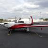
I am a believer in Stormscopes. I have never gotten into severe turbulence relying on a WX900. I also have NEXRAD displayed on a GTS 750 and I like it a lot but a great deal of the yellow and even red is benign rain. I have gone through a lot of NEXRAD red that the Stormscope did not paint and the ride was always fine.  The pic is from last week. With Nancy along I wanted to keep us in smooth conditions. Even on a day like last Thursday there is a lot more airspace that's fine than storm.


30 plus years ago in my first M20E, before I installed a Ryan WX-9A, with only ATC for help, coming home from Chicago IFR, at night, over eastern KY, alone, I wound up in an embedded cell that ATC sent me through as my best path through a line. He didn't paint it so I suppose it was just building when he had given me a heading. I was in an updraft that took me up over 3000' in a matter of seconds. It was everything I could do to keep the airspeed between 80 and 130 and bank angles below 45. (When ATC asked about the altitude excursion I told him I would correct when able and that I pitied any other poor slob who might be near me. 


When near "stuff" keep your seatbelt tight, secure loose objects in the cabin, and keep a cool head. Your bird won't break if you can keep it under control.  


http://flightaware.com/live/flight/N943RW


post-8913-0-93090200-1433258195_thumb.jp

Link to comment
Share on other sites

I have a free NOAA weather app on my Samsung phone and my iPad. Here on the pad, the icon is labelled "Aviation WX" and is a drawing of the southeastern US from a prog chart, complete with a front, and both High and Low pressure systems. The droid app is labeled "Aviation Weather" and the icon is again the southeast but with an occluded front cutting through FL.

Very, very useful for preflight weather study!

Link to comment
Share on other sites

Mike I do the same flight you do but every two weeks KORL-KFXE. If there are large build ups I just fly underneath them even when they show red on the radar. The ride is less turbulent and less fearful and you can see where the downpours are.

José

Link to comment
Share on other sites


So my questions to others are:


1) How do you use the information available to you to determine the thunderstorm risks when you are 8-10 hours out of taking a flight (or a return flight).

2) Do you let the normal afternoon patterns in Florida deter you from flying in the summer?  I am not talking about tropical disturbances or anything like that.  I have found that over the past 3 years my summer flying drops off considerably and I think it is subconsciously (and now consciously) the thunderstorm issue.

3) Have you found yourself in a thunderstorm before?  If so, how did you get yourself in it and what did you learn from the experience?

4) Do you feel confident that ATC in Florida has the understanding and equipment to keep you out of thunderstorms?

 1) Books are written on this question. 8 to 10 hours out, look at TAF's, lifting index, front location and movements.

2) Not yes but hell yes. TS here are mean ones, don't challenge them.

3) No, but if I did, continue to fly thru the storm at VA, wings level. heck with Alt up and down drafts. That is what is preached and teached.

4) Yes, but it is still on you.

Link to comment
Share on other sites

With Florida's rainy season back upon us, I wanted to get some other opinions on what people use as their flying criteria in the summer.

The vast majority of my travel is between Orlando and Miami, departing in the morning and coming back in the afternoon. Obviously this return trip puts me in the prime time for afternoon thunderstorms. My travel schedule is very flexible most of the time, so I can adjust my travel days to line up with what the weather is saying and avoid the known bad days.

Lately I have developed a rather irrational fear of getting caught up in a thunderstorm and coming out the bottom as a non-flying hunk of metal. I think it really took hold when the PC-12 went down last year near Ocala with what was first attributed to an unsuccessful encounter with a thunderstorm (which has since been revised to bad flying when the autopilot disconnected for some reason - a topic unto itself). I say it is irrational because it becomes almost paralyzing (flying-wise) at times. I understand the importance of good risk management and use ADS-B weather enroute, so its not that I feel I'm flying by the seat of my pants.

So my questions to others are:

1) How do you use the information available to you to determine the thunderstorm risks when you are 8-10 hours out of taking a flight (or a return flight).

2) Do you let the normal afternoon patterns in Florida deter you from flying in the summer? I am not talking about tropical disturbances or anything like that. I have found that over the past 3 years my summer flying drops off considerably and I think it is subconsciously (and now consciously) the thunderstorm issue.

3) Have you found yourself in a thunderstorm before? If so, how did you get yourself in it and what did you learn from the experience?

4) Do you feel confident that ATC in Florida has the understanding and equipment to keep you out of thunderstorms?

Beechtalk had a recent thread on this topic:

http://www.beechtalk.com/forums/viewtopic.php?f=42&t=105816

We have found that the controllers in Florida generally knowledgeable about the weather, and very helpful. We find satellite weather invaluable.

Link to comment
Share on other sites

  • 1 month later...

For me, I was a CFII with a student working on his instrument. 

Flying into thunderstorms, ... it only takes once to learn that lesson! Flying low on fuel? Yeah, that one only takes one time to learn too!


Your account is every bit as harrowing as I thought it would be. Like I said, you were the lucky few to live to tell the tale.  

Link to comment
Share on other sites

You did the right thing Dave. My rule when on descent or into clouds is to throttle back and slow down. If there is any turbulence activity it will reduce the stress on the plane and on the occupants. It also helps to tighten the shoulder belt (keeps from bumping your head) and grab on the windshield center tube. I have ridden on the updrafts and it can get you into the high teens with no power. The effect is of short duration. When encountering them I just ride on it maintaining wings level and heading. If you turn you may end up back in the updraft.

José

Link to comment
Share on other sites

  • 1 month later...

I also worry about flying cross country in Florida during the summer. I don't have any wisdom other than if most of the terminals en route are reporting vcts at the same time I don't go. Some hangar days I am amazed at how bad it gets. Just the other day there was traffic in the pattern and I was working on the Mooney seats. Within two hours dark clouds rolled in and then in a few minutes the airport was completely unusable. I just try to remember that it's fun to visit other airports so an unplanned stop is an opportunity.

Sent from my iPad using Tapatalk

Link to comment
Share on other sites

Join the conversation

You can post now and register later. If you have an account, sign in now to post with your account.

Guest
Reply to this topic...

×   Pasted as rich text.   Paste as plain text instead

  Only 75 emoji are allowed.

×   Your link has been automatically embedded.   Display as a link instead

×   Your previous content has been restored.   Clear editor

×   You cannot paste images directly. Upload or insert images from URL.

×
×
  • Create New...

Important Information

We have placed cookies on your device to help make this website better. You can adjust your cookie settings, otherwise we'll assume you're okay to continue.